La Plaza geodata
La Plaza (Asturias) is a populated place; located in Spain in Europe/Madrid (GMT+2) time zone. With population of 2,029 people, there are 2150 cities with bigger population in this country. Compared to other cities in Spain, 96% of cities are located further ↓South; 87.4% of cities are located further →East and 61.4% of cities have higher elevation than La Plaza. Note1


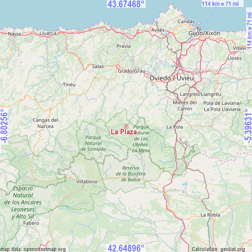
La Plaza GPS coordinates[2]
43° 9' 50.292" North, 6° 5' 57.948" West
| Map corner | latitude | longitude |
|---|---|---|
| Upper-left | 43.67468°, | -6.80256° |
| Center: | 43.16397°, | -6.09943° |
| Lower-right: | 42.64896°, | -5.39631° |
| Map W x H: | 114×114 km | = 70.8×70.8mi |
| max Lat: | 43.74134° ⇑4% North |
| La Plaza: | 43.16397° |
| min Lat: | ⇓96% South 27.64134° |
| min Long | La Plaza | max Long |
| -18.00367° | -6.09943° | 4.2899° |
| W 12.6%⇐ | ⇒87.4% E |
Elevation
Elevation of La Plaza is 506 m = 1660 ft, and this is 92 m = 302 ft below average elevation for this country.
| Max E: |
1682 m = 5518 ft | 61.4% |
| Avg. | 598 m = 1962 ft | |
| La Plaza | 506 m = 1660 ft | |
Min E: |
0 m = 0 ft | 38.6% |
See also: Spain elevation on elevation.city.
Geographical zone
La Plaza is located in North temperate zone (between Tropic of Cancer and the Arctic Circle). Distance of this Northern Tropic circle is 2193.5 km =1363 mi to South.| Distance of | km | miles | from La Plaza |
|---|---|---|---|
| North Pole | 5207.7 | 3235.9 | to North |
| Arctic Circle | 2601.8 | 1616.7 | to North |
| Tropic Cancer | 2193.5 | 1363 | to South |
| Equator | 4799.4 | 2982.2 | to South |


Nearby cities:
15 places around La Plaza: (largest is in red/bold)
• Belmonte
16.3 km =10.1 mi,  323°
323°
• Bárzana
10.2 km =6.3 mi,  94°
94°
• Cabrillanes
23.7 km =14.7 mi,  189°
189°
• Castandiello
21.2 km =13.2 mi,  52°
52°
• Grado
25 km =15.5 mi,  4°
4°
• Mieres
28.6 km =17.8 mi,  70°
70°
• Oviedo
30 km =18.6 mi,  43°
43°
• Pola de Lena
22 km =13.7 mi, 90°
• Pola de Somiedo
15 km =9.3 mi,  238°
238°
• Proaza
11.9 km =7.4 mi,  34°
34°
• Salas
30.5 km =19 mi,  334°
334°
• San Claudio
25.4 km =15.8 mi, 35°
• San Emiliano
22.8 km =14.2 mi,  159°
159°
• Sena de Luna
28.7 km =17.8 mi, 155°
• Villablino
30.7 km =19.1 mi,  215°
215°
Sources, notices
• [Note1] Compared only with cities in Spain existing in our database
• [Src1] Map data: © OpenStreetMap contributors (CC-BY-SA)
• [Src2] Other city data from geonames.org with taken over terms of usage.
• [Src3] Geographical zone / Annual Mean Temperature by Robert A. Rohde @ Wikipedia
