Valtierra geodata
Valtierra (Navarre) is a seat of a third-order administrative division; located in Spain in Europe/Madrid (GMT+2) time zone. With population of 2,435 people, there are 1923 cities with bigger population in this country. Compared to other cities in Spain, 79.2% of cities are located further ↓South; 71.6% of cities are located further ←West and 77.1% of cities have higher elevation than Valtierra. Note1


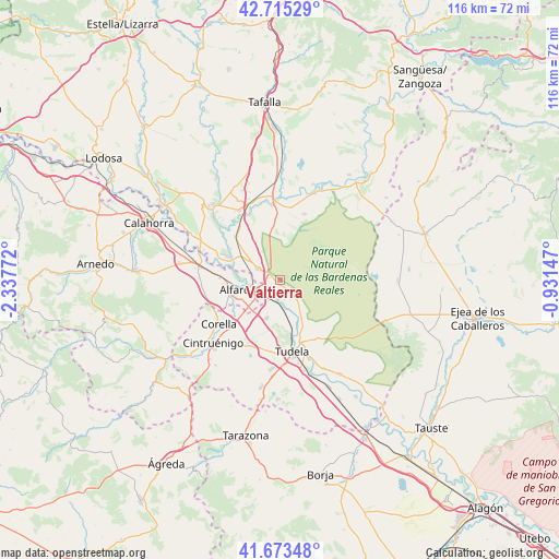
Valtierra GPS coordinates[2]
42° 11' 47.508" North, 1° 38' 4.524" West
| Map corner | latitude | longitude |
|---|---|---|
| Upper-left | 42.71529°, | -2.33772° |
| Center: | 42.19653°, | -1.63459° |
| Lower-right: | 41.67348°, | -0.93147° |
| Map W x H: | 115.8×115.8 km | = 72×72mi |
| max Lat: | 43.74134° ⇑20.8% North |
| Valtierra: | 42.19653° |
| min Lat: | ⇓79.2% South 27.64134° |
| min Long | Valtierra | max Long |
| -18.00367° | -1.63459° | 4.2899° |
| W 71.6%⇐ | ⇒28.4% E |
Elevation
Elevation of Valtierra is 268 m = 879 ft, and this is 330 m = 1083 ft below average elevation for this country.
| Max E: |
1682 m = 5518 ft | 77.1% |
| Avg. | 598 m = 1962 ft | |
| Valtierra | 268 m = 879 ft | |
Min E: |
0 m = 0 ft | 22.9% |
See also: Spain elevation on elevation.city.
Geographical zone
Valtierra is located in North temperate zone (between Tropic of Cancer and the Arctic Circle). Distance of this Northern Tropic circle is 2085.9 km =1296.1 mi to South.| Distance of | km | miles | from Valtierra |
|---|---|---|---|
| North Pole | 5315.2 | 3302.7 | to North |
| Arctic Circle | 2709.4 | 1683.5 | to North |
| Tropic Cancer | 2085.9 | 1296.1 | to South |
| Equator | 4691.8 | 2915.3 | to South |


Nearby cities:
15 places around Valtierra: (largest is in red/bold)
• Alfaro
9.7 km =6 mi,  259°
259°
• Arguedas
3.7 km =2.3 mi,  124°
124°
• Cadreita
4.6 km =2.9 mi,  299°
299°
• Caparroso
16.1 km =10 mi,  355°
355°
• Castejón
5.5 km =3.4 mi,  236°
236°
• Cintruénigo
19.1 km =11.9 mi,  227°
227°
• Corella
15.4 km =9.6 mi, 233°
• Funes
19 km =11.8 mi,  314°
314°
• Marcilla
16.9 km =10.5 mi,  329°
329°
• Milagro
11.9 km =7.4 mi,  294°
294°
• Murchante
18.4 km =11.4 mi,  185°
185°
• Rincón de Soto
18.4 km =11.4 mi,  283°
283°
• Santacara
18.9 km =11.7 mi,  0°
0°
• Tudela
15.2 km =9.4 mi,  170°
170°
• Villafranca
13 km =8.1 mi,  315°
315°
Sources, notices
• [Note1] Compared only with cities in Spain existing in our database
• [Src1] Map data: © OpenStreetMap contributors (CC-BY-SA)
• [Src2] Other city data from geonames.org with taken over terms of usage.
• [Src3] Geographical zone / Annual Mean Temperature by Robert A. Rohde @ Wikipedia
