Vall-Llobrega geodata
Vall-Llobrega (Catalonia) is a populated place; located in Spain in Europe/Madrid (GMT+2) time zone. With population of 651 people, there are 3499 cities with bigger population in this country. Compared to other cities in Spain, 70.5% of cities are located further ↓South; 99.5% of cities are located further ←West and 91.9% of cities have higher elevation than Vall-Llobrega. Note1


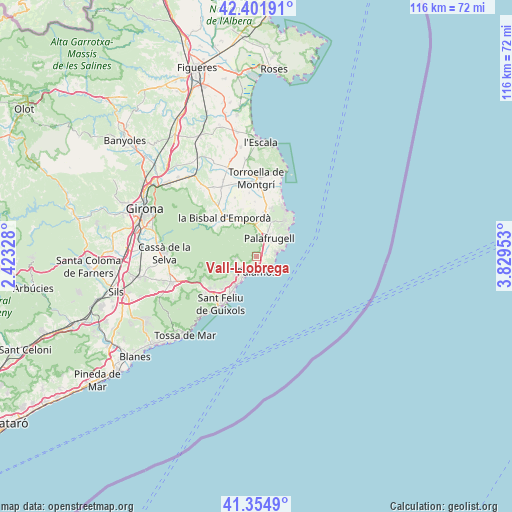
Vall-Llobrega GPS coordinates[2]
41° 52' 49.98" North, 3° 7' 35.076" East
| Map corner | latitude | longitude |
|---|---|---|
| Upper-left | 42.40191°, | 2.42328° |
| Center: | 41.88055°, | 3.12641° |
| Lower-right: | 41.3549°, | 3.82953° |
| Map W x H: | 116.4×116.4 km | = 72.3×72.3mi |
| max Lat: | 43.74134° ⇑29.5% North |
| Vall-Llobrega: | 41.88055° |
| min Lat: | ⇓70.5% South 27.64134° |
| min Long | Vall-Llobrega | max Long |
| -18.00367° | 3.12641° | 4.2899° |
| W 99.5%⇐ | ⇒0.5% E |
Elevation
Elevation of Vall-Llobrega is 45 m = 148 ft, and this is 553 m = 1814 ft below average elevation for this country.
| Max E: |
1682 m = 5518 ft | 91.9% |
| Avg. | 598 m = 1962 ft | |
| Vall-Llobrega | 45 m = 148 ft | |
Min E: |
0 m = 0 ft | 8.1% |
See also: Spain elevation on elevation.city.
Geographical zone
Vall-Llobrega is located in North temperate zone (between Tropic of Cancer and the Arctic Circle). Distance of this Northern Tropic circle is 2050.8 km =1274.3 mi to South.| Distance of | km | miles | from Vall-Llobrega |
|---|---|---|---|
| North Pole | 5350.4 | 3324.6 | to North |
| Arctic Circle | 2744.5 | 1705.4 | to North |
| Tropic Cancer | 2050.8 | 1274.3 | to South |
| Equator | 4656.7 | 2893.5 | to South |


Nearby cities:
15 places around Vall-Llobrega: (largest is in red/bold)
• Begur
10.7 km =6.6 mi,  44°
44°
• Calella de Palafrugell
5.1 km =3.2 mi,  75°
75°
• Calonge
4.6 km =2.9 mi,  238°
238°
• Castell-Platja d'Aro
8.5 km =5.3 mi,  214°
214°
• Cruïlles
11.9 km =7.4 mi,  310°
310°
• Palafrugell
5.1 km =3.2 mi, 36°
• Palamós
3.6 km =2.2 mi,  176°
176°
• Palau-sator
12.1 km =7.5 mi,  353°
353°
• Pals
10.2 km =6.3 mi,  10°
10°
• Regencós
8.8 km =5.5 mi,  24°
24°
• S'Agaró
11.4 km =7.1 mi, 211°
• Sant Feliu de Guíxols
13.3 km =8.3 mi,  215°
215°
• Santa Cristina d'Aro
12.7 km =7.9 mi, 235°
• Torrent
8 km =5 mi,  0°
0°
• la Bisbal d'Empordà
10 km =6.2 mi,  320°
320°
Sources, notices
• [Note1] Compared only with cities in Spain existing in our database
• [Src1] Map data: © OpenStreetMap contributors (CC-BY-SA)
• [Src2] Other city data from geonames.org with taken over terms of usage.
• [Src3] Geographical zone / Annual Mean Temperature by Robert A. Rohde @ Wikipedia
