Castell-Platja d'Aro geodata
Castell-Platja d'Aro (Catalonia) is a seat of a third-order administrative division; located in Spain in Europe/Madrid (GMT+2) time zone. With population of 10,376 people, there are 835 cities with bigger population in this country. Compared to other cities in Spain, 69% of cities are located further ↓South; 99.2% of cities are located further ←West and 98.9% of cities have higher elevation than Castell-Platja d'Aro. Note1
Administrative division(s):
- Level 1: Catalonia
- Level 2: Província de Girona
- Level 3: Castell-Platja d'Aro


Castell-Platja d'Aro GPS coordinates[2]
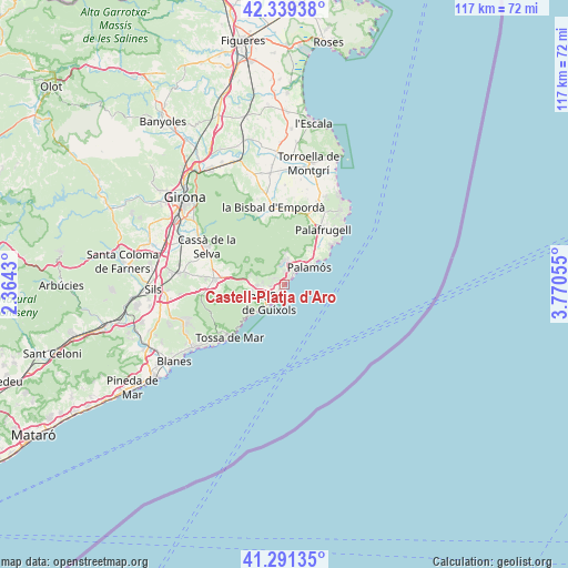
41° 49' 3.036" North, 3° 4' 2.712" East
| Map corner | latitude | longitude |
|---|---|---|
| Upper-left | 42.33938°, | 2.3643° |
| Center: | 41.81751°, | 3.06742° |
| Lower-right: | 41.29135°, | 3.77055° |
| Map W x H: | 116.5×116.5 km | = 72.4×72.4mi |
| max Lat: | 43.74134° ⇑31% North |
| Castell-Platja d'Aro: | 41.81751° |
| min Lat: | ⇓69% South 27.64134° |
| min Long | Castell-Platja | max Long |
| -18.00367° | 3.06742° | 4.2899° |
| W 99.2%⇐ | ⇒0.8% E |
Elevation
Elevation of Castell-Platja d'Aro is 8 m = 26 ft, and this is 590 m = 1936 ft below average elevation for this country.
| Max E: |
1682 m = 5518 ft | 98.9% |
| Avg. | 598 m = 1962 ft | |
| Castell-Platja d'Aro | 8 m = 26 ft | |
Min E: |
0 m = 0 ft | 1.1% |
See also: Spain elevation on elevation.city.
Geographical zone
Castell-Platja d'Aro is located in North temperate zone (between Tropic of Cancer and the Arctic Circle). Distance of this Northern Tropic circle is 2043.8 km =1270 mi to South.| Distance of | km | miles | from Castell-Platja d'Aro |
|---|---|---|---|
| North Pole | 5357.4 | 3328.9 | to North |
| Arctic Circle | 2751.5 | 1709.7 | to North |
| Tropic Cancer | 2043.8 | 1270 | to South |
| Equator | 4649.7 | 2889.2 | to South |


Nearby cities:
15 places around Castell-Platja d'Aro: (largest is in red/bold)
• Calella de Palafrugell
12.9 km =8 mi,  50°
50°
• Calonge
4.7 km =2.9 mi,  12°
12°
• Cassà de la Selva
17.7 km =11 mi,  296°
296°
• Cruïlles
15.3 km =9.5 mi,  344°
344°
• Llagostera
14.4 km =8.9 mi,  274°
274°
• Palafrugell
13.6 km =8.5 mi,  35°
35°
• Palamós
6.2 km =3.9 mi,  56°
56°
• Regencós
17.3 km =10.7 mi,  29°
29°
• S'Agaró
2.9 km =1.8 mi,  203°
203°
• Sant Feliu de Guíxols
4.7 km =2.9 mi,  216°
216°
• Santa Cristina d'Aro
5.6 km =3.5 mi, 269°
• Torrent
15.8 km =9.8 mi,  18°
18°
• Tossa de Mar
15.8 km =9.8 mi, 224°
• Vall-Llobrega
8.5 km =5.3 mi, 34°
• la Bisbal d'Empordà
14.8 km =9.2 mi,  354°
354°
Sources, notices
• [Note1] Compared only with cities in Spain existing in our database
• [Src1] Map data: © OpenStreetMap contributors (CC-BY-SA)
• [Src2] Other city data from geonames.org with taken over terms of usage.
• [Src3] Geographical zone / Annual Mean Temperature by Robert A. Rohde @ Wikipedia
