S'Agaró geodata
S'Agaró (Catalonia) is a populated place; located in Spain in Europe/Madrid (GMT+2) time zone. With population of 1,237 people, there are 2695 cities with bigger population in this country. Compared to other cities in Spain, 68.3% of cities are located further ↓South; 99.1% of cities are located further ←West and 96.6% of cities have higher elevation than S'Agaró. Note1
Administrative division(s):
- Level 1: Catalonia
- Level 2: Província de Girona
- Level 3: Castell-Platja d'Aro


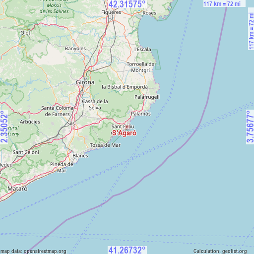
S'Agaró GPS coordinates[2]
41° 47' 37.248" North, 3° 3' 13.104" East
| Map corner | latitude | longitude |
|---|---|---|
| Upper-left | 42.31575°, | 2.35052° |
| Center: | 41.79368°, | 3.05364° |
| Lower-right: | 41.26732°, | 3.75677° |
| Map W x H: | 116.6×116.6 km | = 72.5×72.5mi |
| max Lat: | 43.74134° ⇑31.7% North |
| S'Agaró: | 41.79368° |
| min Lat: | ⇓68.3% South 27.64134° |
| min Long | S'Agaró | max Long |
| -18.00367° | 3.05364° | 4.2899° |
| W 99.1%⇐ | ⇒0.90000000000001% E |
Elevation
Elevation of S'Agaró is 17 m = 56 ft, and this is 581 m = 1906 ft below average elevation for this country.
| Max E: |
1682 m = 5518 ft | 96.6% |
| Avg. | 598 m = 1962 ft | |
| S'Agaró | 17 m = 56 ft | |
Min E: |
0 m = 0 ft | 3.4% |
See also: Spain elevation on elevation.city.
Geographical zone
S'Agaró is located in North temperate zone (between Tropic of Cancer and the Arctic Circle). Distance of this Northern Tropic circle is 2041.1 km =1268.3 mi to South.| Distance of | km | miles | from S'Agaró |
|---|---|---|---|
| North Pole | 5360 | 3330.5 | to North |
| Arctic Circle | 2754.2 | 1711.4 | to North |
| Tropic Cancer | 2041.1 | 1268.3 | to South |
| Equator | 4647 | 2887.5 | to South |


Nearby cities:
15 places around S'Agaró: (largest is in red/bold)
• Calella de Palafrugell
15.5 km =9.6 mi,  45°
45°
• Calonge
7.5 km =4.7 mi,  16°
16°
• Cassà de la Selva
18.1 km =11.2 mi,  305°
305°
• Castell-Platja d'Aro
2.9 km =1.8 mi, 23°
• Cruïlles
17.6 km =10.9 mi,  350°
350°
• Llagostera
13.8 km =8.6 mi,  285°
285°
• Palafrugell
16.5 km =10.3 mi,  33°
33°
• Palamós
8.7 km =5.4 mi, 45°
• Sant Andreu Salou
20 km =12.4 mi, 293°
• Sant Feliu de Guíxols
2 km =1.2 mi,  235°
235°
• Santa Cristina d'Aro
5.1 km =3.2 mi,  299°
299°
• Torrent
18.7 km =11.6 mi, 18°
• Tossa de Mar
13.1 km =8.1 mi,  229°
229°
• Vall-Llobrega
11.4 km =7.1 mi, 31°
• la Bisbal d'Empordà
17.4 km =10.8 mi,  359°
359°
Sources, notices
• [Note1] Compared only with cities in Spain existing in our database
• [Src1] Map data: © OpenStreetMap contributors (CC-BY-SA)
• [Src2] Other city data from geonames.org with taken over terms of usage.
• [Src3] Geographical zone / Annual Mean Temperature by Robert A. Rohde @ Wikipedia
