Huérmeces geodata
Huérmeces (Castille and León) is a seat of a third-order administrative division; located in Spain in Europe/Madrid (GMT+2) time zone. With population of 127 people, there are 5616 cities with bigger population in this country. Compared to other cities in Spain, 87.7% of cities are located further ↓South; 56.3% of cities are located further →East and 79.2% of cities have lower elevation than Huérmeces. Note1
Administrative division(s):
- Level 1: Castille and León
- Level 2: Provincia de Burgos
- Level 3: Huérmeces


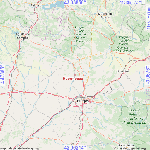
Huérmeces GPS coordinates[2]
42° 31' 21" North, 3° 46' 14.592" West
| Map corner | latitude | longitude |
|---|---|---|
| Upper-left | 43.03856°, | -4.47385° |
| Center: | 42.5225°, | -3.77072° |
| Lower-right: | 42.00214°, | -3.0676° |
| Map W x H: | 115.2×115.2 km | = 71.6×71.6mi |
| max Lat: | 43.74134° ⇑12.3% North |
| Huérmeces: | 42.5225° |
| min Lat: | ⇓87.7% South 27.64134° |
| min Long | Huérmeces | max Long |
| -18.00367° | -3.77072° | 4.2899° |
| W 43.7%⇐ | ⇒56.3% E |
Elevation
Elevation of Huérmeces is 890 m = 2920 ft, and this is 292 m = 958 ft above average elevation for this country.
| Max E: |
1682 m = 5518 ft | 20.8% |
| Huérmeces | 890 m 2920 ft | |
| Avg. | 598 m = 1962 ft | |
Min E: |
0 m = 0 ft | 79.2% |
See also: Spain elevation on elevation.city.
Geographical zone
Huérmeces is located in North temperate zone (between Tropic of Cancer and the Arctic Circle). Distance of this Northern Tropic circle is 2122.1 km =1318.6 mi to South.| Distance of | km | miles | from Huérmeces |
|---|---|---|---|
| North Pole | 5279 | 3280.2 | to North |
| Arctic Circle | 2673.1 | 1661 | to North |
| Tropic Cancer | 2122.1 | 1318.6 | to South |
| Equator | 4728.1 | 2937.9 | to South |


Nearby cities:
15 places around Huérmeces: (largest is in red/bold)
• Abajas
19.2 km =11.9 mi,  54°
54°
• Gamonal
20.1 km =12.5 mi,  156°
156°
• Hurones
18.2 km =11.3 mi,  135°
135°
• Manciles
16 km =9.9 mi,  243°
243°
• Montorio
6.9 km =4.3 mi,  355°
355°
• Pedrosa del Páramo
18.8 km =11.7 mi, 241°
• Quintanaortuño
10.8 km =6.7 mi, 138°
• Quintanilla-Vivar
13.6 km =8.5 mi,  150°
150°
• Santibáñez-Zarzaguda
4.8 km =3 mi,  191°
191°
• Sotragero
13.4 km =8.3 mi, 159°
• Susinos del Páramo
13.9 km =8.6 mi,  245°
245°
• Tardajos
19.7 km =12.2 mi, 191°
• Tobar
14.5 km =9 mi, 252°
• Villadiego
19.6 km =12.2 mi,  267°
267°
• Villalbilla de Burgos
19.5 km =12.1 mi,  182°
182°
Sources, notices
• [Note1] Compared only with cities in Spain existing in our database
• [Src1] Map data: © OpenStreetMap contributors (CC-BY-SA)
• [Src2] Other city data from geonames.org with taken over terms of usage.
• [Src3] Geographical zone / Annual Mean Temperature by Robert A. Rohde @ Wikipedia
