Montorio geodata
Montorio (Castille and León) is a seat of a third-order administrative division; located in Spain in Europe/Madrid (GMT+2) time zone. With population of 177 people, there are 5203 cities with bigger population in this country. Compared to other cities in Spain, 89.1% of cities are located further ↓South; 56.4% of cities are located further →East and 84.9% of cities have lower elevation than Montorio. Note1
Administrative division(s):
- Level 1: Castille and León
- Level 2: Provincia de Burgos
- Level 3: Montorio


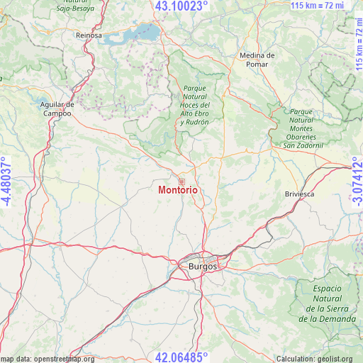
Montorio GPS coordinates[2]
42° 35' 4.884" North, 3° 46' 38.064" West
| Map corner | latitude | longitude |
|---|---|---|
| Upper-left | 43.10023°, | -4.48037° |
| Center: | 42.58469°, | -3.77724° |
| Lower-right: | 42.06485°, | -3.07412° |
| Map W x H: | 115.1×115.1 km | = 71.5×71.5mi |
| max Lat: | 43.74134° ⇑10.9% North |
| Montorio: | 42.58469° |
| min Lat: | ⇓89.1% South 27.64134° |
| min Long | Montorio | max Long |
| -18.00367° | -3.77724° | 4.2899° |
| W 43.6%⇐ | ⇒56.4% E |
Elevation
Elevation of Montorio is 950 m = 3117 ft, and this is 352 m = 1155 ft above average elevation for this country.
| Max E: |
1682 m = 5518 ft | 15.1% |
| Montorio | 950 m 3117 ft | |
| Avg. | 598 m = 1962 ft | |
Min E: |
0 m = 0 ft | 84.9% |
See also: Spain elevation on elevation.city.
Geographical zone
Montorio is located in North temperate zone (between Tropic of Cancer and the Arctic Circle). Distance of this Northern Tropic circle is 2129.1 km =1323 mi to South.| Distance of | km | miles | from Montorio |
|---|---|---|---|
| North Pole | 5272.1 | 3275.9 | to North |
| Arctic Circle | 2666.2 | 1656.7 | to North |
| Tropic Cancer | 2129.1 | 1323 | to South |
| Equator | 4735 | 2942.2 | to South |


Nearby cities:
15 places around Montorio: (largest is in red/bold)
• Abajas
16.6 km =10.3 mi,  75°
75°
• Basconcillos del Tozo
21.7 km =13.5 mi,  307°
307°
• Huérmeces
6.9 km =4.3 mi,  175°
175°
• Manciles
19.7 km =12.2 mi,  224°
224°
• Pedrosa del Páramo
22.5 km =14 mi,  225°
225°
• Quintanaortuño
16.8 km =10.4 mi,  152°
152°
• Quintanilla-Vivar
20.1 km =12.5 mi,  158°
158°
• Santibáñez-Zarzaguda
11.6 km =7.2 mi, 182°
• Sargentes de la Lora
21.9 km =13.6 mi,  339°
339°
• Sedano
14.8 km =9.2 mi,  8°
8°
• Sotragero
20.1 km =12.5 mi, 164°
• Susinos del Páramo
17.5 km =10.9 mi, 223°
• Tobar
17.4 km =10.8 mi, 229°
• Tubilla del Agua
14 km =8.7 mi,  351°
351°
• Villadiego
20.5 km =12.7 mi,  248°
248°
Sources, notices
• [Note1] Compared only with cities in Spain existing in our database
• [Src1] Map data: © OpenStreetMap contributors (CC-BY-SA)
• [Src2] Other city data from geonames.org with taken over terms of usage.
• [Src3] Geographical zone / Annual Mean Temperature by Robert A. Rohde @ Wikipedia
