Santibáñez el Bajo geodata
Santibáñez el Bajo (Extremadura) is a seat of a third-order administrative division; located in Spain in Europe/Madrid (GMT+2) time zone. With population of 900 people, there are 3067 cities with bigger population in this country. Compared to other cities in Spain, 67.6% of cities are located further ↑North; 88.8% of cities are located further →East and 70.4% of cities have higher elevation than Santibáñez el Bajo. Note1
Administrative division(s):
- Level 1: Extremadura
- Level 2: Provincia de Cáceres
- Level 3: Santibáñez el Bajo


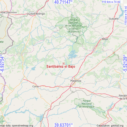
Santibáñez el Bajo GPS coordinates[2]
40° 10' 34.932" North, 6° 13' 27.876" West
| Map corner | latitude | longitude |
|---|---|---|
| Upper-left | 40.71147°, | -6.92754° |
| Center: | 40.17637°, | -6.22441° |
| Lower-right: | 39.63701°, | -5.52129° |
| Map W x H: | 119.5×119.5 km | = 74.3×74.3mi |
| max Lat: | 43.74134° ⇑67.6% North |
| Santibáñez el Bajo: | 40.17637° |
| min Lat: | ⇓32.4% South 27.64134° |
| min Long | Santibáñez el | max Long |
| -18.00367° | -6.22441° | 4.2899° |
| W 11.2%⇐ | ⇒88.8% E |
Elevation
Elevation of Santibáñez el Bajo is 374 m = 1227 ft, and this is 224 m = 735 ft below average elevation for this country.
| Max E: |
1682 m = 5518 ft | 70.4% |
| Avg. | 598 m = 1962 ft | |
| Santibáñez el Bajo | 374 m = 1227 ft | |
Min E: |
0 m = 0 ft | 29.6% |
See also: Spain elevation on elevation.city.
Geographical zone
Santibáñez el Bajo is located in North temperate zone (between Tropic of Cancer and the Arctic Circle). Distance of this Northern Tropic circle is 1861.3 km =1156.6 mi to South.| Distance of | km | miles | from Santibáñez el Bajo |
|---|---|---|---|
| North Pole | 5539.9 | 3442.3 | to North |
| Arctic Circle | 2934 | 1823.1 | to North |
| Tropic Cancer | 1861.3 | 1156.6 | to South |
| Equator | 4467.2 | 2775.8 | to South |


Nearby cities:
15 places around Santibáñez el Bajo: (largest is in red/bold)
• Aceituna
9.7 km =6 mi,  252°
252°
• Ahigal
3.4 km =2.1 mi,  64°
64°
• Carcaboso
14.1 km =8.8 mi,  176°
176°
• Casar de Palomero
13.5 km =8.4 mi,  348°
348°
• Cerezo
6.7 km =4.2 mi,  357°
357°
• Guijo de Granadilla
5.5 km =3.4 mi,  69°
69°
• Marchagaz
11 km =6.8 mi,  337°
337°
• Montehermoso
14.5 km =9 mi,  227°
227°
• Oliva de Plasencia
13.7 km =8.5 mi,  121°
121°
• Palomero
9 km =5.6 mi,  330°
330°
• Pozuelo de Zarzón
16.5 km =10.3 mi,  258°
258°
• Santa Cruz de Paniagua
10 km =6.2 mi,  279°
279°
• Valdeobispo
10.6 km =6.6 mi,  190°
190°
• Villanueva de la Sierra
15.7 km =9.8 mi, 280°
• Zarza de Granadilla
16.4 km =10.2 mi, 65°
Sources, notices
• [Note1] Compared only with cities in Spain existing in our database
• [Src1] Map data: © OpenStreetMap contributors (CC-BY-SA)
• [Src2] Other city data from geonames.org with taken over terms of usage.
• [Src3] Geographical zone / Annual Mean Temperature by Robert A. Rohde @ Wikipedia
