Marchagaz geodata
Marchagaz (Extremadura) is a seat of a third-order administrative division; located in Spain in Europe/Madrid (GMT+2) time zone. With population of 281 people, there are 4581 cities with bigger population in this country. Compared to other cities in Spain, 66.2% of cities are located further ↑North; 89.2% of cities are located further →East and 60.6% of cities have higher elevation than Marchagaz. Note1


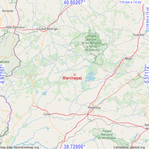
Marchagaz GPS coordinates[2]
40° 16' 3.684" North, 6° 16' 29.46" West
| Map corner | latitude | longitude |
|---|---|---|
| Upper-left | 40.80207°, | -6.97797° |
| Center: | 40.26769°, | -6.27485° |
| Lower-right: | 39.72906°, | -5.57172° |
| Map W x H: | 119.3×119.3 km | = 74.1×74.1mi |
| max Lat: | 43.74134° ⇑66.2% North |
| Marchagaz: | 40.26769° |
| min Lat: | ⇓33.8% South 27.64134° |
| min Long | Marchagaz | max Long |
| -18.00367° | -6.27485° | 4.2899° |
| W 10.8%⇐ | ⇒89.2% E |
Elevation
Elevation of Marchagaz is 519 m = 1703 ft, and this is 79 m = 259 ft below average elevation for this country.
| Max E: |
1682 m = 5518 ft | 60.6% |
| Avg. | 598 m = 1962 ft | |
| Marchagaz | 519 m = 1703 ft | |
Min E: |
0 m = 0 ft | 39.4% |
See also: Spain elevation on elevation.city.
Geographical zone
Marchagaz is located in North temperate zone (between Tropic of Cancer and the Arctic Circle). Distance of this Northern Tropic circle is 1871.4 km =1162.8 mi to South.| Distance of | km | miles | from Marchagaz |
|---|---|---|---|
| North Pole | 5529.7 | 3436 | to North |
| Arctic Circle | 2923.8 | 1816.8 | to North |
| Tropic Cancer | 1871.4 | 1162.8 | to South |
| Equator | 4477.3 | 2782.1 | to South |


Nearby cities:
15 places around Marchagaz: (largest is in red/bold)
• Aceituna
14 km =8.7 mi,  200°
200°
• Ahigal
11.4 km =7.1 mi,  139°
139°
• Caminomorisco
6.7 km =4.2 mi,  349°
349°
• Casar de Palomero
3.4 km =2.1 mi,  26°
26°
• Cerezo
5.3 km =3.3 mi,  130°
130°
• Guijo de Granadilla
12.6 km =7.8 mi, 131°
• Hernán-Pérez
17.3 km =10.7 mi,  249°
249°
• La Pesga
10.6 km =6.6 mi,  52°
52°
• Nuñomoral
15.7 km =9.8 mi,  8°
8°
• Palomero
2.3 km =1.4 mi,  184°
184°
• Pinofranqueado
6.3 km =3.9 mi,  309°
309°
• Santa Cruz de Paniagua
10.1 km =6.3 mi,  213°
213°
• Santibáñez el Bajo
11 km =6.8 mi,  157°
157°
• Torrecilla de los Ángeles
12.2 km =7.6 mi,  259°
259°
• Villanueva de la Sierra
13.3 km =8.3 mi,  236°
236°
Sources, notices
• [Note1] Compared only with cities in Spain existing in our database
• [Src1] Map data: © OpenStreetMap contributors (CC-BY-SA)
• [Src2] Other city data from geonames.org with taken over terms of usage.
• [Src3] Geographical zone / Annual Mean Temperature by Robert A. Rohde @ Wikipedia
