San Esteban de los Patos geodata
San Esteban de los Patos (Castille and León) is a seat of a third-order administrative division; located in Spain in Europe/Madrid (GMT+2) time zone. With population of 36 people, there are 6610 cities with bigger population in this country. Compared to other cities in Spain, 57.2% of cities are located further ↑North; 67.6% of cities are located further →East and 93.9% of cities have lower elevation than San Esteban de los Patos. Note1
Administrative division(s):
- Level 1: Castille and León
- Level 2: Provincia de Ávila
- Level 3: San Esteban de los Patos
Current local time in San Esteban de los Patos:
10:39 PM, ThursdayDifference from your time zone: hours


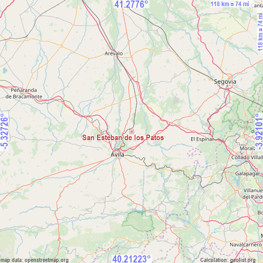
San Esteban de los Patos GPS coordinates[2]
40° 44' 49.38" North, 4° 37' 26.868" West
| Map corner | latitude | longitude |
|---|---|---|
| Upper-left | 41.2776°, | -5.32726° |
| Center: | 40.74705°, | -4.62413° |
| Lower-right: | 40.21223°, | -3.92101° |
| Map W x H: | 118.5×118.5 km | = 73.6×73.6mi |
| max Lat: | 43.74134° ⇑57.2% North |
| San Esteban de los Patos: | 40.74705° |
| min Lat: | ⇓42.8% South 27.64134° |
| min Long | San Esteban de | max Long |
| -18.00367° | -4.62413° | 4.2899° |
| W 32.4%⇐ | ⇒67.6% E |
Elevation
Elevation of San Esteban de los Patos is 1114 m = 3655 ft, and this is 516 m = 1693 ft above average elevation for this country.
| Max E: |
1682 m = 5518 ft | 6.1% |
| San Esteban de los Patos | 1114 m 3655 ft | |
| Avg. | 598 m = 1962 ft | |
Min E: |
0 m = 0 ft | 93.9% |
See also: Spain elevation on elevation.city.
Geographical zone
San Esteban de los Patos is located in North temperate zone (between Tropic of Cancer and the Arctic Circle). Distance of this Northern Tropic circle is 1924.7 km =1196 mi to South.| Distance of | km | miles | from San Esteban de los Patos |
|---|---|---|---|
| North Pole | 5476.4 | 3402.9 | to North |
| Arctic Circle | 2870.5 | 1783.6 | to North |
| Tropic Cancer | 1924.7 | 1196 | to South |
| Equator | 4530.6 | 2815.2 | to South |


Nearby cities:
15 places around San Esteban de los Patos: (largest is in red/bold)
• Berrocalejo de Aragona
6.4 km =4 mi,  157°
157°
• Cardeñosa
10.3 km =6.4 mi,  267°
267°
• Gotarrendura
13.2 km =8.2 mi,  311°
311°
• Maello
11.7 km =7.3 mi,  53°
53°
• Mediana de Voltoya
7.2 km =4.5 mi,  134°
134°
• Mingorría
3.6 km =2.2 mi,  278°
278°
• Ojos-Albos
10.2 km =6.3 mi,  116°
116°
• Peñalba de Ávila
10.6 km =6.6 mi,  285°
285°
• Pozanco
7 km =4.3 mi,  328°
328°
• Santo Domingo de las Posadas
7.3 km =4.5 mi,  353°
353°
• Tolbaños
3.6 km =2.2 mi,  81°
81°
• Tornadizos de Ávila
13.3 km =8.3 mi,  176°
176°
• Vega de Santa María
10 km =6.2 mi, 350°
• Velayos
10.5 km =6.5 mi,  0°
0°
• Ávila
11.8 km =7.3 mi,  212°
212°
Sources, notices
• [Note1] Compared only with cities in Spain existing in our database
• [Src1] Map data: © OpenStreetMap contributors (CC-BY-SA)
• [Src2] Other city data from geonames.org with taken over terms of usage.
• [Src3] Geographical zone / Annual Mean Temperature by Robert A. Rohde @ Wikipedia
