Mingorría geodata
Mingorría (Castille and León) is a seat of a third-order administrative division; located in Spain in Europe/Madrid (GMT+2) time zone. With population of 465 people, there are 3974 cities with bigger population in this country. Compared to other cities in Spain, 57.1% of cities are located further ↑North; 68.2% of cities are located further →East and 90.4% of cities have lower elevation than Mingorría. Note1
Administrative division(s):
- Level 1: Castille and León
- Level 2: Provincia de Ávila
- Level 3: Mingorría


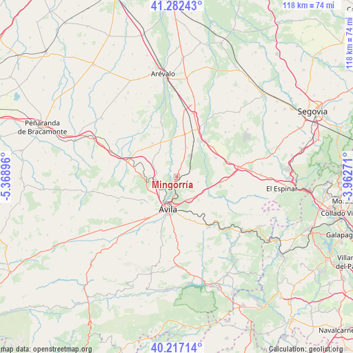
Mingorría GPS coordinates[2]
40° 45' 6.912" North, 4° 39' 56.988" West
| Map corner | latitude | longitude |
|---|---|---|
| Upper-left | 41.28243°, | -5.36896° |
| Center: | 40.75192°, | -4.66583° |
| Lower-right: | 40.21714°, | -3.96271° |
| Map W x H: | 118.4×118.4 km | = 73.6×73.6mi |
| max Lat: | 43.74134° ⇑57.1% North |
| Mingorría: | 40.75192° |
| min Lat: | ⇓42.9% South 27.64134° |
| min Long | Mingorría | max Long |
| -18.00367° | -4.66583° | 4.2899° |
| W 31.8%⇐ | ⇒68.2% E |
Elevation
Elevation of Mingorría is 1037 m = 3402 ft, and this is 439 m = 1440 ft above average elevation for this country.
| Max E: |
1682 m = 5518 ft | 9.6% |
| Mingorría | 1037 m 3402 ft | |
| Avg. | 598 m = 1962 ft | |
Min E: |
0 m = 0 ft | 90.4% |
See also: Spain elevation on elevation.city.
Geographical zone
Mingorría is located in North temperate zone (between Tropic of Cancer and the Arctic Circle). Distance of this Northern Tropic circle is 1925.3 km =1196.3 mi to South.| Distance of | km | miles | from Mingorría |
|---|---|---|---|
| North Pole | 5475.9 | 3402.6 | to North |
| Arctic Circle | 2870 | 1783.3 | to North |
| Tropic Cancer | 1925.3 | 1196.3 | to South |
| Equator | 4531.2 | 2815.6 | to South |


Nearby cities:
15 places around Mingorría: (largest is in red/bold)
• Berrocalejo de Aragona
8.8 km =5.5 mi,  136°
136°
• Cardeñosa
6.8 km =4.2 mi,  261°
261°
• Gotarrendura
10.4 km =6.5 mi,  322°
322°
• Hernansancho
12.9 km =8 mi,  335°
335°
• Martiherrero
13.1 km =8.1 mi,  228°
228°
• Mediana de Voltoya
10.3 km =6.4 mi,  123°
123°
• Monsalupe
9.9 km =6.2 mi,  281°
281°
• Peñalba de Ávila
7.1 km =4.4 mi,  288°
288°
• Pozanco
5.5 km =3.4 mi,  358°
358°
• San Esteban de los Patos
3.6 km =2.2 mi,  98°
98°
• Santo Domingo de las Posadas
7.2 km =4.5 mi,  21°
21°
• Tolbaños
7.1 km =4.4 mi,  90°
90°
• Vega de Santa María
9.6 km =6 mi,  11°
11°
• Velayos
10.6 km =6.6 mi, 19°
• Ávila
10.9 km =6.8 mi,  195°
195°
Sources, notices
• [Note1] Compared only with cities in Spain existing in our database
• [Src1] Map data: © OpenStreetMap contributors (CC-BY-SA)
• [Src2] Other city data from geonames.org with taken over terms of usage.
• [Src3] Geographical zone / Annual Mean Temperature by Robert A. Rohde @ Wikipedia
