Requejo geodata
Requejo (Castille and León) is a seat of a third-order administrative division; located in Spain in Europe/Madrid (GMT+2) time zone. In our database, there are 6762 cities with bigger population. Compared to other cities in Spain, 74.5% of cities are located further ↓South; 93.1% of cities are located further →East and 87.8% of cities have lower elevation than Requejo. Note1
Administrative division(s):
- Level 1: Castille and León
- Level 2: Provincia de Zamora
- Level 3: Requejo


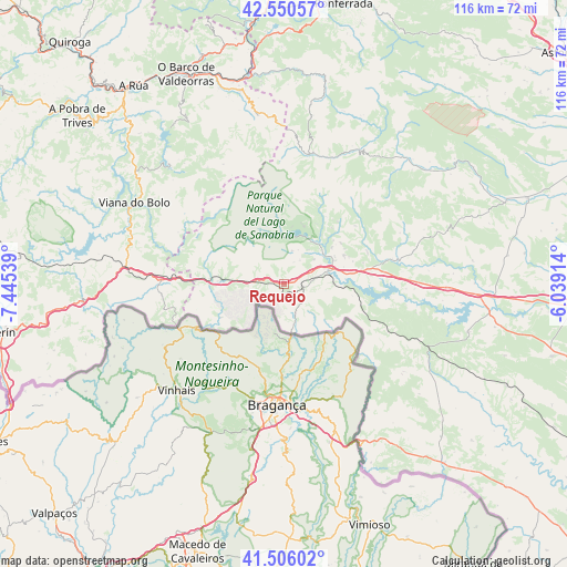
Requejo GPS coordinates[2]
42° 1' 49.584" North, 6° 44' 32.172" West
| Map corner | latitude | longitude |
|---|---|---|
| Upper-left | 42.55057°, | -7.44539° |
| Center: | 42.03044°, | -6.74227° |
| Lower-right: | 41.50602°, | -6.03914° |
| Map W x H: | 116.1×116.1 km | = 72.1×72.1mi |
| max Lat: | 43.74134° ⇑25.5% North |
| Requejo: | 42.03044° |
| min Lat: | ⇓74.5% South 27.64134° |
| min Long | Requejo | max Long |
| -18.00367° | -6.74227° | 4.2899° |
| W 6.9%⇐ | ⇒93.1% E |
Elevation
Elevation of Requejo is 993 m = 3258 ft, and this is 395 m = 1296 ft above average elevation for this country.
| Max E: |
1682 m = 5518 ft | 12.2% |
| Requejo | 993 m 3258 ft | |
| Avg. | 598 m = 1962 ft | |
Min E: |
0 m = 0 ft | 87.8% |
See also: Spain elevation on elevation.city.
Geographical zone
Requejo is located in North temperate zone (between Tropic of Cancer and the Arctic Circle). Distance of this Northern Tropic circle is 2067.4 km =1284.6 mi to South.| Distance of | km | miles | from Requejo |
|---|---|---|---|
| North Pole | 5333.7 | 3314.2 | to North |
| Arctic Circle | 2727.8 | 1695 | to North |
| Tropic Cancer | 2067.4 | 1284.6 | to South |
| Equator | 4673.3 | 2903.9 | to South |


Nearby cities:
15 places around Requejo: (largest is in red/bold)
• Asturianos
21 km =13 mi,  83°
83°
• Cernadilla
26.9 km =16.7 mi,  92°
92°
• Cobreros
5.9 km =3.7 mi,  35°
35°
• Encinedo
29.4 km =18.3 mi,  24°
24°
• Galende
10.5 km =6.5 mi, 38°
• Hermisende
14.4 km =8.9 mi,  241°
241°
• Lubián
13.5 km =8.4 mi,  272°
272°
• Manzanal de Arriba
25.3 km =15.7 mi,  99°
99°
• Palacios de Sanabria
18.3 km =11.4 mi, 80°
• Porto
20 km =12.4 mi,  319°
319°
• Puebla de Sanabria
9.4 km =5.8 mi,  73°
73°
• Pías
22.1 km =13.7 mi,  285°
285°
• Robleda-Cervantes
13.5 km =8.4 mi,  64°
64°
• San Justo
15 km =9.3 mi, 40°
• Trefacio
12.5 km =7.8 mi, 35°
Sources, notices
• [Note1] Compared only with cities in Spain existing in our database
• [Src1] Map data: © OpenStreetMap contributors (CC-BY-SA)
• [Src2] Other city data from geonames.org with taken over terms of usage.
• [Src3] Geographical zone / Annual Mean Temperature by Robert A. Rohde @ Wikipedia
