Cobreros geodata
Cobreros (Castille and León) is a seat of a third-order administrative division; located in Spain in Europe/Madrid (GMT+2) time zone. With population of 650 people, there are 3500 cities with bigger population in this country. Compared to other cities in Spain, 75.8% of cities are located further ↓South; 92.8% of cities are located further →East and 87.8% of cities have lower elevation than Cobreros. Note1
Administrative division(s):
- Level 1: Castille and León
- Level 2: Provincia de Zamora
- Level 3: Cobreros


Cobreros GPS coordinates[2]
42° 4' 23.628" North, 6° 42' 1.908" West
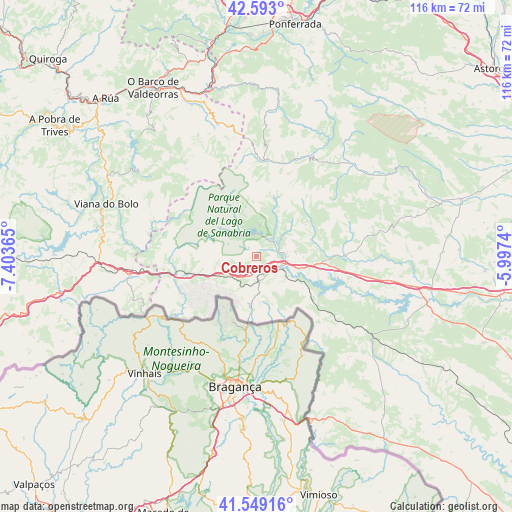
| Map corner | latitude | longitude |
|---|---|---|
| Upper-left | 42.593°, | -7.40365° |
| Center: | 42.07323°, | -6.70053° |
| Lower-right: | 41.54916°, | -5.9974° |
| Map W x H: | 116.1×116.1 km | = 72.1×72.1mi |
| max Lat: | 43.74134° ⇑24.2% North |
| Cobreros: | 42.07323° |
| min Lat: | ⇓75.8% South 27.64134° |
| min Long | Cobreros | max Long |
| -18.00367° | -6.70053° | 4.2899° |
| W 7.2%⇐ | ⇒92.8% E |
Elevation
Elevation of Cobreros is 994 m = 3261 ft, and this is 396 m = 1299 ft above average elevation for this country.
| Max E: |
1682 m = 5518 ft | 12.2% |
| Cobreros | 994 m 3261 ft | |
| Avg. | 598 m = 1962 ft | |
Min E: |
0 m = 0 ft | 87.8% |
See also: Spain elevation on elevation.city.
Geographical zone
Cobreros is located in North temperate zone (between Tropic of Cancer and the Arctic Circle). Distance of this Northern Tropic circle is 2072.2 km =1287.6 mi to South.| Distance of | km | miles | from Cobreros |
|---|---|---|---|
| North Pole | 5329 | 3311.3 | to North |
| Arctic Circle | 2723.1 | 1692.1 | to North |
| Tropic Cancer | 2072.2 | 1287.6 | to South |
| Equator | 4678.1 | 2906.8 | to South |


Nearby cities:
15 places around Cobreros: (largest is in red/bold)
• Asturianos
17.6 km =10.9 mi,  97°
97°
• Cernadilla
24.1 km =15 mi, 103°
• Encinedo
23.6 km =14.7 mi,  21°
21°
• Galende
4.7 km =2.9 mi,  42°
42°
• Hermisende
19.9 km =12.4 mi,  234°
234°
• Lubián
17.4 km =10.8 mi,  256°
256°
• Manzanal de Arriba
23.3 km =14.5 mi,  112°
112°
• Palacios de Sanabria
14.7 km =9.1 mi, 96°
• Porto
19.5 km =12.1 mi,  302°
302°
• Puebla de Sanabria
5.9 km =3.7 mi, 111°
• Pías
24.7 km =15.3 mi,  272°
272°
• Requejo
5.9 km =3.7 mi,  215°
215°
• Robleda-Cervantes
8.8 km =5.5 mi,  83°
83°
• San Justo
9.2 km =5.7 mi, 43°
• Trefacio
6.6 km =4.1 mi, 35°
Sources, notices
• [Note1] Compared only with cities in Spain existing in our database
• [Src1] Map data: © OpenStreetMap contributors (CC-BY-SA)
• [Src2] Other city data from geonames.org with taken over terms of usage.
• [Src3] Geographical zone / Annual Mean Temperature by Robert A. Rohde @ Wikipedia
