Navamorcuende geodata
Navamorcuende (Castille-La Mancha) is a seat of a third-order administrative division; located in Spain in Europe/Madrid (GMT+2) time zone. With population of 702 people, there are 3401 cities with bigger population in this country. Compared to other cities in Spain, 67.8% of cities are located further ↑North; 69.6% of cities are located further →East and 64.1% of cities have lower elevation than Navamorcuende. Note1
Administrative division(s):
- Level 1: Castille-La Mancha
- Level 2: Province of Toledo
- Level 3: Navamorcuende


Navamorcuende GPS coordinates[2]
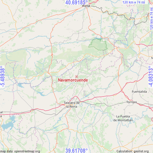
40° 9' 23.724" North, 4° 47' 10.5" West
| Map corner | latitude | longitude |
|---|---|---|
| Upper-left | 40.69185°, | -5.48938° |
| Center: | 40.15659°, | -4.78625° |
| Lower-right: | 39.61708°, | -4.08313° |
| Map W x H: | 119.5×119.5 km | = 74.3×74.3mi |
| max Lat: | 43.74134° ⇑67.8% North |
| Navamorcuende: | 40.15659° |
| min Lat: | ⇓32.2% South 27.64134° |
| min Long | Navamorcuende | max Long |
| -18.00367° | -4.78625° | 4.2899° |
| W 30.4%⇐ | ⇒69.6% E |
Elevation
Elevation of Navamorcuende is 772 m = 2533 ft, and this is 174 m = 571 ft above average elevation for this country.
| Max E: |
1682 m = 5518 ft | 35.9% |
| Navamorcuende | 772 m 2533 ft | |
| Avg. | 598 m = 1962 ft | |
Min E: |
0 m = 0 ft | 64.1% |
See also: Spain elevation on elevation.city.
Geographical zone
Navamorcuende is located in North temperate zone (between Tropic of Cancer and the Arctic Circle). Distance of this Northern Tropic circle is 1859.1 km =1155.2 mi to South.| Distance of | km | miles | from Navamorcuende |
|---|---|---|---|
| North Pole | 5542.1 | 3443.7 | to North |
| Arctic Circle | 2936.2 | 1824.5 | to North |
| Tropic Cancer | 1859.1 | 1155.2 | to South |
| Equator | 4465 | 2774.4 | to South |


Nearby cities:
15 places around Navamorcuende: (largest is in red/bold)
• Almendral de la Cañada
4.9 km =3 mi,  50°
50°
• Buenaventura
5.9 km =3.7 mi,  292°
292°
• Cardiel de los Montes
15.2 km =9.4 mi,  132°
132°
• Casavieja
14.2 km =8.8 mi,  6°
6°
• Castillo de Bayuela
10.6 km =6.6 mi, 126°
• Cervera de los Montes
11.8 km =7.3 mi,  190°
190°
• El Real de San Vicente
8.4 km =5.2 mi,  106°
106°
• Gavilanes
14.6 km =9.1 mi,  337°
337°
• Hinojosa de San Vicente
7.9 km =4.9 mi,  136°
136°
• Lanzahita
13.8 km =8.6 mi, 293°
• Montesclaros
14.1 km =8.8 mi,  246°
246°
• Nuño Gómez
14.9 km =9.3 mi, 108°
• Pedro Bernardo
14.2 km =8.8 mi,  312°
312°
• Sartajada
6.3 km =3.9 mi,  353°
353°
• Sotillo de las Palomas
6.9 km =4.3 mi,  210°
210°
Sources, notices
• [Note1] Compared only with cities in Spain existing in our database
• [Src1] Map data: © OpenStreetMap contributors (CC-BY-SA)
• [Src2] Other city data from geonames.org with taken over terms of usage.
• [Src3] Geographical zone / Annual Mean Temperature by Robert A. Rohde @ Wikipedia
