Buenaventura geodata
Buenaventura (Castille-La Mancha) is a seat of a third-order administrative division; located in Spain in Europe/Madrid (GMT+2) time zone. With population of 500 people, there are 3886 cities with bigger population in this country. Compared to other cities in Spain, 67.6% of cities are located further ↑North; 70.5% of cities are located further →East and 67% of cities have higher elevation than Buenaventura. Note1
Administrative division(s):
- Level 1: Castille-La Mancha
- Level 2: Province of Toledo
- Level 3: Buenaventura


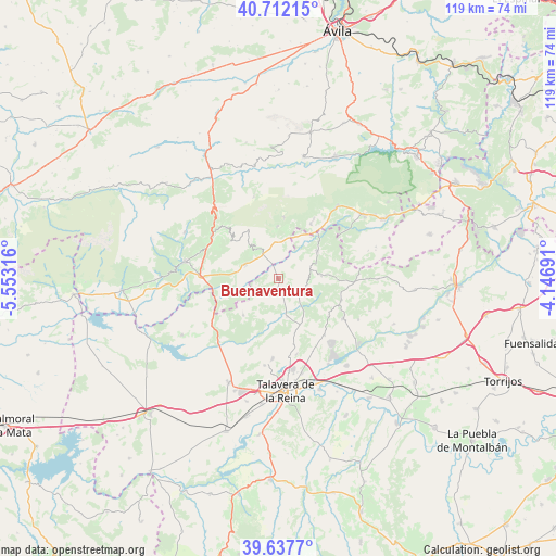
Buenaventura GPS coordinates[2]
40° 10' 37.38" North, 4° 51' 0.108" West
| Map corner | latitude | longitude |
|---|---|---|
| Upper-left | 40.71215°, | -5.55316° |
| Center: | 40.17705°, | -4.85003° |
| Lower-right: | 39.6377°, | -4.14691° |
| Map W x H: | 119.5×119.5 km | = 74.3×74.3mi |
| max Lat: | 43.74134° ⇑67.6% North |
| Buenaventura: | 40.17705° |
| min Lat: | ⇓32.4% South 27.64134° |
| min Long | Buenaventura | max Long |
| -18.00367° | -4.85003° | 4.2899° |
| W 29.5%⇐ | ⇒70.5% E |
Elevation
Elevation of Buenaventura is 432 m = 1417 ft, and this is 166 m = 545 ft below average elevation for this country.
| Max E: |
1682 m = 5518 ft | 67% |
| Avg. | 598 m = 1962 ft | |
| Buenaventura | 432 m = 1417 ft | |
Min E: |
0 m = 0 ft | 33% |
See also: Spain elevation on elevation.city.
Geographical zone
Buenaventura is located in North temperate zone (between Tropic of Cancer and the Arctic Circle). Distance of this Northern Tropic circle is 1861.4 km =1156.6 mi to South.| Distance of | km | miles | from Buenaventura |
|---|---|---|---|
| North Pole | 5539.8 | 3442.3 | to North |
| Arctic Circle | 2933.9 | 1823 | to North |
| Tropic Cancer | 1861.4 | 1156.6 | to South |
| Equator | 4467.3 | 2775.9 | to South |


Nearby cities:
15 places around Buenaventura: (largest is in red/bold)
• Almendral de la Cañada
9.2 km =5.7 mi,  84°
84°
• Casavieja
13.8 km =8.6 mi,  30°
30°
• Cervera de los Montes
14.3 km =8.9 mi,  166°
166°
• El Real de San Vicente
14.3 km =8.9 mi,  108°
108°
• Gavilanes
11.2 km =7 mi,  358°
358°
• Hinojosa de San Vicente
13.5 km =8.4 mi,  126°
126°
• Lanzahita
7.9 km =4.9 mi,  293°
293°
• Mijares
13.3 km =8.3 mi,  4°
4°
• Montesclaros
10.9 km =6.8 mi,  223°
223°
• Navamorcuende
5.9 km =3.7 mi, 112°
• Pedro Bernardo
8.8 km =5.5 mi,  325°
325°
• San Esteban del Valle
15.6 km =9.7 mi,  314°
314°
• Santa Cruz del Valle
15.3 km =9.5 mi,  302°
302°
• Sartajada
6.2 km =3.9 mi,  49°
49°
• Sotillo de las Palomas
8.4 km =5.2 mi, 166°
Sources, notices
• [Note1] Compared only with cities in Spain existing in our database
• [Src1] Map data: © OpenStreetMap contributors (CC-BY-SA)
• [Src2] Other city data from geonames.org with taken over terms of usage.
• [Src3] Geographical zone / Annual Mean Temperature by Robert A. Rohde @ Wikipedia
