Méntrida geodata
Méntrida (Castille-La Mancha) is a seat of a third-order administrative division; located in Spain in Europe/Madrid (GMT+2) time zone. With population of 3,143 people, there are 1680 cities with bigger population in this country. Compared to other cities in Spain, 66.6% of cities are located further ↑North; 62.5% of cities are located further →East and 59.1% of cities have higher elevation than Méntrida. Note1
Administrative division(s):
- Level 1: Castille-La Mancha
- Level 2: Province of Toledo
- Level 3: Méntrida


Méntrida GPS coordinates[2]
40° 14' 20.364" North, 4° 11' 36.132" West
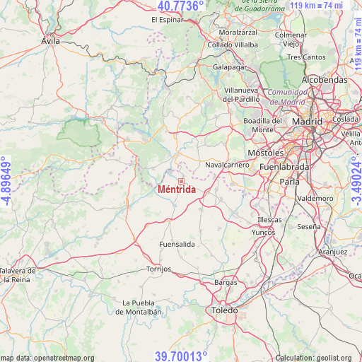
| Map corner | latitude | longitude |
|---|---|---|
| Upper-left | 40.7736°, | -4.89649° |
| Center: | 40.23899°, | -4.19337° |
| Lower-right: | 39.70013°, | -3.49024° |
| Map W x H: | 119.4×119.4 km | = 74.2×74.2mi |
| max Lat: | 43.74134° ⇑66.6% North |
| Méntrida: | 40.23899° |
| min Lat: | ⇓33.4% South 27.64134° |
| min Long | Méntrida | max Long |
| -18.00367° | -4.19337° | 4.2899° |
| W 37.5%⇐ | ⇒62.5% E |
Elevation
Elevation of Méntrida is 539 m = 1768 ft, and this is 59 m = 194 ft below average elevation for this country.
| Max E: |
1682 m = 5518 ft | 59.1% |
| Avg. | 598 m = 1962 ft | |
| Méntrida | 539 m = 1768 ft | |
Min E: |
0 m = 0 ft | 40.9% |
See also: Spain elevation on elevation.city.
Geographical zone
Méntrida is located in North temperate zone (between Tropic of Cancer and the Arctic Circle). Distance of this Northern Tropic circle is 1868.2 km =1160.8 mi to South.| Distance of | km | miles | from Méntrida |
|---|---|---|---|
| North Pole | 5532.9 | 3438 | to North |
| Arctic Circle | 2927 | 1818.8 | to North |
| Tropic Cancer | 1868.2 | 1160.8 | to South |
| Equator | 4474.2 | 2780.1 | to South |


Nearby cities:
15 places around Méntrida: (largest is in red/bold)
• Aldea del Fresno
9.4 km =5.8 mi,  354°
354°
• Almorox
16.7 km =10.4 mi,  268°
268°
• Casarrubios del Monte
14.5 km =9 mi,  113°
113°
• Chapinería
15.6 km =9.7 mi, 354°
• El Álamo
16.9 km =10.5 mi,  93°
93°
• La Torre de Esteban Hambrán
8 km =5 mi,  193°
193°
• Las Ventas de Retamosa
11.5 km =7.1 mi,  144°
144°
• Navalcarnero
16.4 km =10.2 mi,  70°
70°
• Navas del Rey
17.1 km =10.6 mi,  343°
343°
• Santa Cruz del Retamar
13.9 km =8.6 mi,  197°
197°
• Valmojado
9.5 km =5.9 mi, 113°
• Villa del Prado
10.5 km =6.5 mi,  294°
294°
• Villamanta
9.8 km =6.1 mi,  47°
47°
• Villamantilla
12.3 km =7.6 mi,  25°
25°
• Villanueva de Perales
14.3 km =8.9 mi, 34°
Sources, notices
• [Note1] Compared only with cities in Spain existing in our database
• [Src1] Map data: © OpenStreetMap contributors (CC-BY-SA)
• [Src2] Other city data from geonames.org with taken over terms of usage.
• [Src3] Geographical zone / Annual Mean Temperature by Robert A. Rohde @ Wikipedia
