El Álamo geodata
El Álamo (Madrid) is a populated place; located in Spain in Europe/Madrid (GMT+2) time zone. With population of 6,754 people, there are 1061 cities with bigger population in this country. Compared to other cities in Spain, 66.8% of cities are located further ↑North; 59.6% of cities are located further →East and 54.2% of cities have higher elevation than El Álamo. Note1


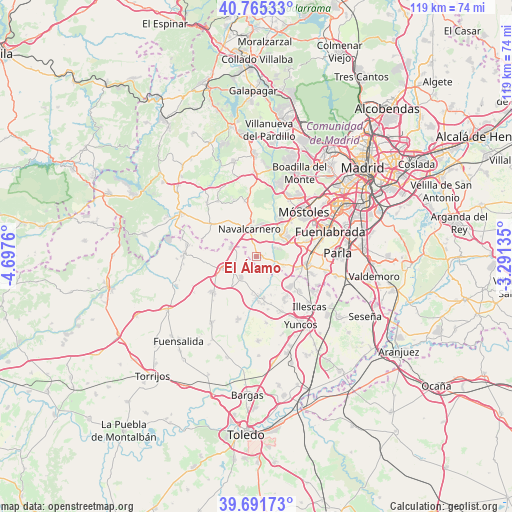
El Álamo GPS coordinates[2]
40° 13' 50.376" North, 3° 59' 40.092" West
| Map corner | latitude | longitude |
|---|---|---|
| Upper-left | 40.76533°, | -4.6976° |
| Center: | 40.23066°, | -3.99447° |
| Lower-right: | 39.69173°, | -3.29135° |
| Map W x H: | 119.4×119.4 km | = 74.2×74.2mi |
| max Lat: | 43.74134° ⇑66.8% North |
| El Álamo: | 40.23066° |
| min Lat: | ⇓33.2% South 27.64134° |
| min Long | El Álamo | max Long |
| -18.00367° | -3.99447° | 4.2899° |
| W 40.4%⇐ | ⇒59.6% E |
Elevation
Elevation of El Álamo is 608 m = 1995 ft, and this is 10 m = 33 ft above average elevation for this country.
| Max E: |
1682 m = 5518 ft | 54.2% |
| El Álamo | 608 m 1995 ft | |
| Avg. | 598 m = 1962 ft | |
Min E: |
0 m = 0 ft | 45.8% |
See also: Spain elevation on elevation.city.
Geographical zone
El Álamo is located in North temperate zone (between Tropic of Cancer and the Arctic Circle). Distance of this Northern Tropic circle is 1867.3 km =1160.3 mi to South.| Distance of | km | miles | from El Álamo |
|---|---|---|---|
| North Pole | 5533.8 | 3438.5 | to North |
| Arctic Circle | 2927.9 | 1819.3 | to North |
| Tropic Cancer | 1867.3 | 1160.3 | to South |
| Equator | 4473.2 | 2779.5 | to South |


Nearby cities:
15 places around El Álamo: (largest is in red/bold)
• Arroyomolinos
7.7 km =4.8 mi,  55°
55°
• Batres
6.5 km =4 mi,  110°
110°
• Carranque
10.4 km =6.5 mi,  130°
130°
• Casarrubios del Monte
6 km =3.7 mi,  216°
216°
• El Viso de San Juan
11.8 km =7.3 mi,  146°
146°
• Griñón
12 km =7.5 mi,  99°
99°
• Las Ventas de Retamosa
13.2 km =8.2 mi,  230°
230°
• Moraleja de Enmedio
11.9 km =7.4 mi,  73°
73°
• Navalcarnero
6.7 km =4.2 mi,  347°
347°
• Palomeque
12.6 km =7.8 mi,  168°
168°
• Serranillos del Valle
10.1 km =6.3 mi, 108°
• Sevilla La Nueva
13.3 km =8.3 mi, 347°
• Ugena
13.1 km =8.1 mi, 129°
• Valmojado
8.7 km =5.4 mi,  250°
250°
• Villamanta
12.3 km =7.6 mi,  307°
307°
Sources, notices
• [Note1] Compared only with cities in Spain existing in our database
• [Src1] Map data: © OpenStreetMap contributors (CC-BY-SA)
• [Src2] Other city data from geonames.org with taken over terms of usage.
• [Src3] Geographical zone / Annual Mean Temperature by Robert A. Rohde @ Wikipedia
