Santibáñez-Zarzaguda geodata
Santibáñez-Zarzaguda (Castille and León) is a populated place; located in Spain in Europe/Madrid (GMT+2) time zone. With population of 554 people, there are 3728 cities with bigger population in this country. Compared to other cities in Spain, 86.7% of cities are located further ↓South; 56.5% of cities are located further →East and 77.9% of cities have lower elevation than Santibáñez-Zarzaguda. Note1
Administrative division(s):
- Level 1: Castille and León
- Level 2: Provincia de Burgos
- Level 3: Valle de Santibáñez


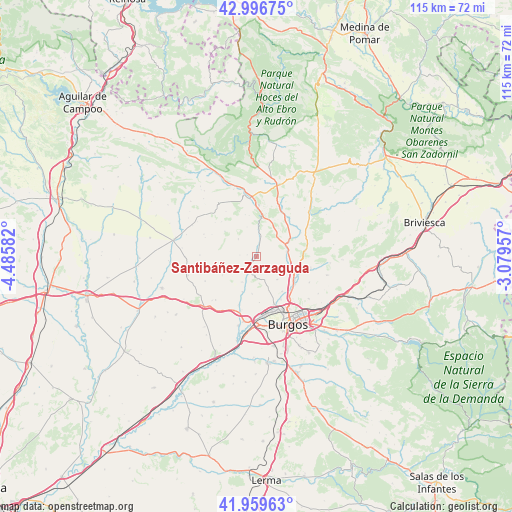
Santibáñez-Zarzaguda GPS coordinates[2]
42° 28' 49.224" North, 3° 46' 57.684" West
| Map corner | latitude | longitude |
|---|---|---|
| Upper-left | 42.99675°, | -4.48582° |
| Center: | 42.48034°, | -3.78269° |
| Lower-right: | 41.95963°, | -3.07957° |
| Map W x H: | 115.3×115.3 km | = 71.6×71.6mi |
| max Lat: | 43.74134° ⇑13.3% North |
| Santibáñez-Zarzaguda: | 42.48034° |
| min Lat: | ⇓86.7% South 27.64134° |
| min Long | Santibáñez-Za | max Long |
| -18.00367° | -3.78269° | 4.2899° |
| W 43.5%⇐ | ⇒56.5% E |
Elevation
Elevation of Santibáñez-Zarzaguda is 878 m = 2881 ft, and this is 280 m = 919 ft above average elevation for this country.
| Max E: |
1682 m = 5518 ft | 22.1% |
| Santibáñez-Zarzaguda | 878 m 2881 ft | |
| Avg. | 598 m = 1962 ft | |
Min E: |
0 m = 0 ft | 77.9% |
See also: Spain elevation on elevation.city.
Geographical zone
Santibáñez-Zarzaguda is located in North temperate zone (between Tropic of Cancer and the Arctic Circle). Distance of this Northern Tropic circle is 2117.5 km =1315.8 mi to South.| Distance of | km | miles | from Santibáñez-Zarzaguda |
|---|---|---|---|
| North Pole | 5283.7 | 3283.1 | to North |
| Arctic Circle | 2677.8 | 1663.9 | to North |
| Tropic Cancer | 2117.5 | 1315.8 | to South |
| Equator | 4723.4 | 2935 | to South |


Nearby cities:
15 places around Santibáñez-Zarzaguda: (largest is in red/bold)
• Gamonal
16.4 km =10.2 mi,  146°
146°
• Hurones
16 km =9.9 mi,  121°
121°
• Huérmeces
4.8 km =3 mi,  11°
11°
• Manciles
13.5 km =8.4 mi,  259°
259°
• Montorio
11.6 km =7.2 mi,  2°
2°
• Pedrosa del Páramo
16.1 km =10 mi,  254°
254°
• Quintanaortuño
8.8 km =5.5 mi,  112°
112°
• Quintanilla-Vivar
10.5 km =6.5 mi,  132°
132°
• Rabé de las Calzadas
16.1 km =10 mi,  195°
195°
• San Mamés de Burgos
16 km =9.9 mi,  183°
183°
• Sotragero
9.7 km =6 mi,  143°
143°
• Susinos del Páramo
11.8 km =7.3 mi, 264°
• Tardajos
14.9 km =9.3 mi,  190°
190°
• Tobar
12.9 km =8 mi,  271°
271°
• Villalbilla de Burgos
14.8 km =9.2 mi, 179°
Sources, notices
• [Note1] Compared only with cities in Spain existing in our database
• [Src1] Map data: © OpenStreetMap contributors (CC-BY-SA)
• [Src2] Other city data from geonames.org with taken over terms of usage.
• [Src3] Geographical zone / Annual Mean Temperature by Robert A. Rohde @ Wikipedia
