O Incio geodata
O Incio (Galicia) is a populated place; located in Spain in Europe/Madrid (GMT+2) time zone. With population of 2,317 people, there are 1991 cities with bigger population in this country. Compared to other cities in Spain, 90.3% of cities are located further ↓South; 95.2% of cities are located further →East and 75.1% of cities have lower elevation than O Incio. Note1


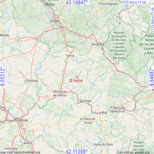
O Incio GPS coordinates[2]
42° 37' 59.988" North, 7° 21' 0" West
| Map corner | latitude | longitude |
|---|---|---|
| Upper-left | 43.14847°, | -8.05312° |
| Center: | 42.63333°, | -7.35° |
| Lower-right: | 42.11389°, | -6.64687° |
| Map W x H: | 115×115 km | = 71.5×71.5mi |
| max Lat: | 43.74134° ⇑9.7% North |
| O Incio: | 42.63333° |
| min Lat: | ⇓90.3% South 27.64134° |
| min Long | O Incio | max Long |
| -18.00367° | -7.35° | 4.2899° |
| W 4.8%⇐ | ⇒95.2% E |
Elevation
Elevation of O Incio is 852 m = 2795 ft, and this is 254 m = 833 ft above average elevation for this country.
| Max E: |
1682 m = 5518 ft | 24.9% |
| O Incio | 852 m 2795 ft | |
| Avg. | 598 m = 1962 ft | |
Min E: |
0 m = 0 ft | 75.1% |
See also: Spain elevation on elevation.city.
Geographical zone
O Incio is located in North temperate zone (between Tropic of Cancer and the Arctic Circle). Distance of this Northern Tropic circle is 2134.5 km =1326.3 mi to South.| Distance of | km | miles | from O Incio |
|---|---|---|---|
| North Pole | 5266.7 | 3272.6 | to North |
| Arctic Circle | 2660.8 | 1653.3 | to North |
| Tropic Cancer | 2134.5 | 1326.3 | to South |
| Equator | 4740.4 | 2945.5 | to South |


Nearby cities:
15 places around O Incio: (largest is in red/bold)
• A Pobra do Brollon
9.2 km =5.7 mi,  201°
201°
• Becerreá
29.1 km =18.1 mi,  31°
31°
• Bóveda
10.4 km =6.5 mi,  264°
264°
• Castro
24.2 km =15 mi,  307°
307°
• Lobios
29.2 km =18.1 mi,  210°
210°
• Láncara
25.7 km =16 mi,  2°
2°
• Monforte de Lemos
18.3 km =11.4 mi,  227°
227°
• Pantón
24.2 km =15 mi,  237°
237°
• Paradela
23.1 km =14.4 mi, 309°
• Portomarín
29 km =18 mi, 311°
• Quiroga
18.5 km =11.5 mi,  160°
160°
• Samos
11 km =6.8 mi,  10°
10°
• Sarria
17.3 km =10.7 mi,  342°
342°
• Sober
27.2 km =16.9 mi, 225°
• Tríacastela
16.2 km =10.1 mi, 33°
Sources, notices
• [Note1] Compared only with cities in Spain existing in our database
• [Src1] Map data: © OpenStreetMap contributors (CC-BY-SA)
• [Src2] Other city data from geonames.org with taken over terms of usage.
• [Src3] Geographical zone / Annual Mean Temperature by Robert A. Rohde @ Wikipedia
