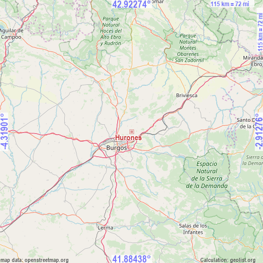
Hurones geodata
Hurones (Castille and León) is a seat of a third-order administrative division; located in Spain in Europe/Madrid (GMT+2) time zone. With population of 71 people, there are 6234 cities with bigger population in this country. Compared to other cities in Spain, 84.9% of cities are located further ↓South; 54% of cities are located further →East and 82.6% of cities have lower elevation than Hurones. Note1
Administrative division(s):
- Level 1: Castille and León
- Level 2: Provincia de Burgos
- Level 3: Hurones


Hurones GPS coordinates[2]
42° 24' 20.556" North, 3° 36' 57.168" West
| Map corner | latitude | longitude |
|---|---|---|
| Upper-left | 42.92274°, | -4.31901° |
| Center: | 42.40571°, | -3.61588° |
| Lower-right: | 41.88438°, | -2.91276° |
| Map W x H: | 115.5×115.5 km | = 71.8×71.8mi |
| max Lat: | 43.74134° ⇑15.1% North |
| Hurones: | 42.40571° |
| min Lat: | ⇓84.9% South 27.64134° |
| min Long | Hurones | max Long |
| -18.00367° | -3.61588° | 4.2899° |
| W 46%⇐ | ⇒54% E |
Elevation
Elevation of Hurones is 923 m = 3028 ft, and this is 325 m = 1066 ft above average elevation for this country.
| Max E: |
1682 m = 5518 ft | 17.4% |
| Hurones | 923 m 3028 ft | |
| Avg. | 598 m = 1962 ft | |
Min E: |
0 m = 0 ft | 82.6% |
See also: Spain elevation on elevation.city.
Geographical zone
Hurones is located in North temperate zone (between Tropic of Cancer and the Arctic Circle). Distance of this Northern Tropic circle is 2109.2 km =1310.6 mi to South.| Distance of | km | miles | from Hurones |
|---|---|---|---|
| North Pole | 5292 | 3288.3 | to North |
| Arctic Circle | 2686.1 | 1669.1 | to North |
| Tropic Cancer | 2109.2 | 1310.6 | to South |
| Equator | 4715.1 | 2929.8 | to South |


Nearby cities:
15 places around Hurones: (largest is in red/bold)
• Atapuerca
9.4 km =5.8 mi,  109°
109°
• Barrios de Colina
12.8 km =8 mi,  94°
94°
• Burgos
10.1 km =6.3 mi,  224°
224°
• Carcedo de Burgos
13.2 km =8.2 mi,  182°
182°
• Cardeñadijo
12.3 km =7.6 mi,  200°
200°
• Cardeñajimeno
8.4 km =5.2 mi, 182°
• Castrillo del Val
10.5 km =6.5 mi,  166°
166°
• Fresno de Rodilla
10.9 km =6.8 mi,  81°
81°
• Gamonal
7.2 km =4.5 mi, 220°
• Ibeas de Juarros
10.6 km =6.6 mi,  141°
141°
• Quintanaortuño
7.4 km =4.6 mi,  311°
311°
• Quintanapalla
6.8 km =4.2 mi, 86°
• Quintanilla-Vivar
6.1 km =3.8 mi,  280°
280°
• Rubena
3.9 km =2.4 mi,  121°
121°
• Sotragero
8 km =5 mi,  273°
273°
Sources, notices
• [Note1] Compared only with cities in Spain existing in our database
• [Src1] Map data: © OpenStreetMap contributors (CC-BY-SA)
• [Src2] Other city data from geonames.org with taken over terms of usage.
• [Src3] Geographical zone / Annual Mean Temperature by Robert A. Rohde @ Wikipedia
