Huarte-Uharte geodata
Huarte-Uharte (Navarre) is a seat of a third-order administrative division; located in Spain in Europe/Madrid (GMT+2) time zone. With population of 3,879 people, there are 1500 cities with bigger population in this country. Compared to other cities in Spain, 93% of cities are located further ↓South; 72.1% of cities are located further ←West and 66.4% of cities have higher elevation than Huarte-Uharte. Note1


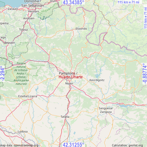
Huarte-Uharte GPS coordinates[2]
42° 49' 49.26" North, 1° 35' 27.132" West
| Map corner | latitude | longitude |
|---|---|---|
| Upper-left | 43.34385°, | -2.294° |
| Center: | 42.83035°, | -1.59087° |
| Lower-right: | 42.31255°, | -0.88774° |
| Map W x H: | 114.7×114.7 km | = 71.3×71.3mi |
| max Lat: | 43.74134° ⇑7% North |
| Huarte-Uharte: | 42.83035° |
| min Lat: | ⇓93% South 27.64134° |
| min Long | Huarte-Uharte | max Long |
| -18.00367° | -1.59087° | 4.2899° |
| W 72.1%⇐ | ⇒27.9% E |
Elevation
Elevation of Huarte-Uharte is 441 m = 1447 ft, and this is 157 m = 515 ft below average elevation for this country.
| Max E: |
1682 m = 5518 ft | 66.4% |
| Avg. | 598 m = 1962 ft | |
| Huarte-Uharte | 441 m = 1447 ft | |
Min E: |
0 m = 0 ft | 33.6% |
See also: Spain elevation on elevation.city.
Geographical zone
Huarte-Uharte is located in North temperate zone (between Tropic of Cancer and the Arctic Circle). Distance of this Northern Tropic circle is 2156.4 km =1339.9 mi to South.| Distance of | km | miles | from Huarte-Uharte |
|---|---|---|---|
| North Pole | 5244.8 | 3259 | to North |
| Arctic Circle | 2638.9 | 1639.7 | to North |
| Tropic Cancer | 2156.4 | 1339.9 | to South |
| Equator | 4762.3 | 2959.2 | to South |


Nearby cities:
15 places around Huarte-Uharte: (largest is in red/bold)
• Atarrabia
1.4 km =0.9 mi,  279°
279°
• Barañáin
7.6 km =4.7 mi,  248°
248°
• Berriobeiti
9.2 km =5.7 mi, 283°
• Berriozar
6.2 km =3.9 mi,  270°
270°
• Burlata
2.2 km =1.4 mi,  255°
255°
• Cizur Mayor
9.4 km =5.8 mi,  239°
239°
• Elorz
11.1 km =6.9 mi,  167°
167°
• Ermitagaña
6.4 km =4 mi, 250°
• Iturrama
6 km =3.7 mi, 246°
• Lizoáin
10.7 km =6.6 mi,  109°
109°
• Orkoien
9.3 km =5.8 mi, 265°
• Pamplona
4.5 km =2.8 mi, 250°
• Primer Ensanche
5 km =3.1 mi, 249°
• Sarriguren
2 km =1.2 mi,  197°
197°
• Segundo Ensanche
4.6 km =2.9 mi, 246°
Sources, notices
• [Note1] Compared only with cities in Spain existing in our database
• [Src1] Map data: © OpenStreetMap contributors (CC-BY-SA)
• [Src2] Other city data from geonames.org with taken over terms of usage.
• [Src3] Geographical zone / Annual Mean Temperature by Robert A. Rohde @ Wikipedia
