Cizur Mayor geodata
Cizur Mayor (Navarre) is a populated place; located in Spain in Europe/Madrid (GMT+2) time zone. With population of 13,345 people, there are 692 cities with bigger population in this country. Compared to other cities in Spain, 92.5% of cities are located further ↓South; 70.8% of cities are located further ←West and 65.7% of cities have higher elevation than Cizur Mayor. Note1
Administrative division(s):
- Level 1: Navarre
- Level 2: Provincia de Navarra
- Level 3: Zizur Mayor/Zizur Nagusia


Cizur Mayor GPS coordinates[2]
42° 47' 16.62" North, 1° 41' 26.34" West
| Map corner | latitude | longitude |
|---|---|---|
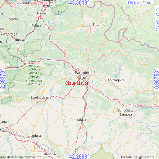
| Upper-left | 43.3018°, | -2.39378° |
| Center: | 42.78795°, | -1.69065° |
| Lower-right: | 42.2698°, | -0.98753° |
| Map W x H: | 114.7×114.7 km | = 71.3×71.3mi |
| max Lat: | 43.74134° ⇑7.5% North |
| Cizur Mayor: | 42.78795° |
| min Lat: | ⇓92.5% South 27.64134° |
| min Long | Cizur Mayor | max Long |
| -18.00367° | -1.69065° | 4.2899° |
| W 70.8%⇐ | ⇒29.2% E |
Elevation
Elevation of Cizur Mayor is 451 m = 1480 ft, and this is 147 m = 482 ft below average elevation for this country.
| Max E: |
1682 m = 5518 ft | 65.7% |
| Avg. | 598 m = 1962 ft | |
| Cizur Mayor | 451 m = 1480 ft | |
Min E: |
0 m = 0 ft | 34.3% |
See also: Spain elevation on elevation.city.
Geographical zone
Cizur Mayor is located in North temperate zone (between Tropic of Cancer and the Arctic Circle). Distance of this Northern Tropic circle is 2151.7 km =1337 mi to South.| Distance of | km | miles | from Cizur Mayor |
|---|---|---|---|
| North Pole | 5249.5 | 3261.9 | to North |
| Arctic Circle | 2643.6 | 1642.7 | to North |
| Tropic Cancer | 2151.7 | 1337 | to South |
| Equator | 4757.6 | 2956.2 | to South |


Nearby cities:
15 places around Cizur Mayor: (largest is in red/bold)
• Atarrabia
8.4 km =5.2 mi,  54°
54°
• Barañáin
2.3 km =1.4 mi,  28°
28°
• Beriáin
7.1 km =4.4 mi,  148°
148°
• Berriobeiti
6.9 km =4.3 mi,  353°
353°
• Berriozar
5.1 km =3.2 mi,  22°
22°
• Burlata
7.3 km =4.5 mi,  55°
55°
• Ermitagaña
3.3 km =2.1 mi,  40°
40°
• Galar
3 km =1.9 mi,  192°
192°
• Iturrama
3.5 km =2.2 mi, 49°
• Itza
6.3 km =3.9 mi,  329°
329°
• Orkoien
4.2 km =2.6 mi,  343°
343°
• Pamplona
5 km =3.1 mi, 50°
• Primer Ensanche
4.5 km =2.8 mi, 48°
• Sarriguren
8 km =5 mi,  69°
69°
• Segundo Ensanche
4.8 km =3 mi, 53°
Sources, notices
• [Note1] Compared only with cities in Spain existing in our database
• [Src1] Map data: © OpenStreetMap contributors (CC-BY-SA)
• [Src2] Other city data from geonames.org with taken over terms of usage.
• [Src3] Geographical zone / Annual Mean Temperature by Robert A. Rohde @ Wikipedia
