Elorz geodata
Elorz (Navarre) is a populated place; located in Spain in Europe/Madrid (GMT+2) time zone. With population of 4,330 people, there are 1412 cities with bigger population in this country. Compared to other cities in Spain, 91.9% of cities are located further ↓South; 72.3% of cities are located further ←West and 63.1% of cities have higher elevation than Elorz. Note1
Administrative division(s):
- Level 1: Navarre
- Level 2: Provincia de Navarra
- Level 3: Noáin (Valle de Elorz)/Noain (Elortzibar)


Elorz GPS coordinates[2]
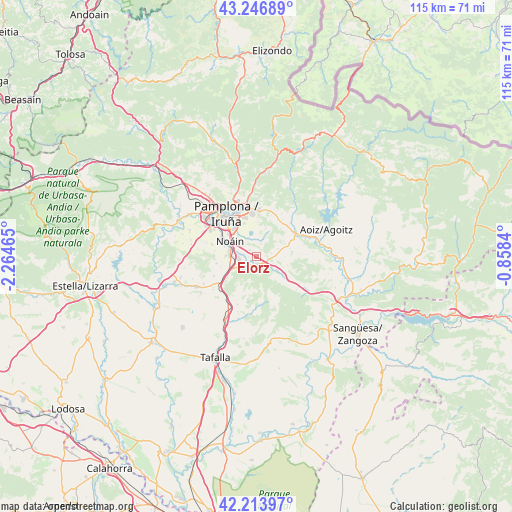
42° 43' 57.288" North, 1° 33' 41.472" West
| Map corner | latitude | longitude |
|---|---|---|
| Upper-left | 43.24689°, | -2.26465° |
| Center: | 42.73258°, | -1.56152° |
| Lower-right: | 42.21397°, | -0.8584° |
| Map W x H: | 114.8×114.8 km | = 71.3×71.3mi |
| max Lat: | 43.74134° ⇑8.1% North |
| Elorz: | 42.73258° |
| min Lat: | ⇓91.9% South 27.64134° |
| min Long | Elorz | max Long |
| -18.00367° | -1.56152° | 4.2899° |
| W 72.3%⇐ | ⇒27.7% E |
Elevation
Elevation of Elorz is 486 m = 1594 ft, and this is 112 m = 367 ft below average elevation for this country.
| Max E: |
1682 m = 5518 ft | 63.1% |
| Avg. | 598 m = 1962 ft | |
| Elorz | 486 m = 1594 ft | |
Min E: |
0 m = 0 ft | 36.9% |
See also: Spain elevation on elevation.city.
Geographical zone
Elorz is located in North temperate zone (between Tropic of Cancer and the Arctic Circle). Distance of this Northern Tropic circle is 2145.5 km =1333.2 mi to South.| Distance of | km | miles | from Elorz |
|---|---|---|---|
| North Pole | 5255.6 | 3265.7 | to North |
| Arctic Circle | 2649.8 | 1646.5 | to North |
| Tropic Cancer | 2145.5 | 1333.2 | to South |
| Equator | 4751.4 | 2952.4 | to South |


Nearby cities:
15 places around Elorz: (largest is in red/bold)
• Atarrabia
11.7 km =7.3 mi,  341°
341°
• Beriáin
6.8 km =4.2 mi,  270°
270°
• Burlata
11.3 km =7 mi, 336°
• Ermitagaña
12.1 km =7.5 mi,  316°
316°
• Galar
11.7 km =7.3 mi,  285°
285°
• Huarte-Uharte
11.1 km =6.9 mi,  347°
347°
• Iturrama
11.6 km =7.2 mi, 316°
• Lizoáin
10.6 km =6.6 mi,  46°
46°
• Monreal
5.4 km =3.4 mi,  125°
125°
• Olóriz
11.6 km =7.2 mi,  201°
201°
• Pamplona
11.5 km =7.1 mi, 324°
• Primer Ensanche
11.6 km =7.2 mi, 322°
• Sarriguren
9.4 km =5.8 mi, 341°
• Segundo Ensanche
11.2 km =7 mi, 323°
• Unzué
10.3 km =6.4 mi,  210°
210°
Sources, notices
• [Note1] Compared only with cities in Spain existing in our database
• [Src1] Map data: © OpenStreetMap contributors (CC-BY-SA)
• [Src2] Other city data from geonames.org with taken over terms of usage.
• [Src3] Geographical zone / Annual Mean Temperature by Robert A. Rohde @ Wikipedia
