San Lorenzo de El Escorial geodata
San Lorenzo de El Escorial (Madrid) is a seat of a third-order administrative division; located in Spain in Europe/Madrid (GMT+2) time zone. With population of 17,889 people, there are 525 cities with bigger population in this country. Compared to other cities in Spain, 60% of cities are located further ↑North; 61.9% of cities are located further →East and 91.1% of cities have lower elevation than San Lorenzo de El Escorial. Note1
Administrative division(s):
- Level 1: Madrid
- Level 2: Provincia de Madrid
- Level 3: San Lorenzo de El Escorial
Current local time in San Lorenzo de El Escorial:
10:45 PM, ThursdayDifference from your time zone: hours


San Lorenzo de El Escorial GPS coordinates[2]
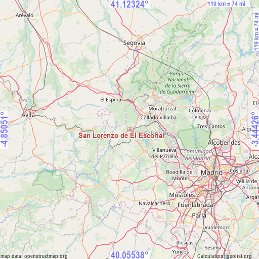
40° 35' 29.184" North, 4° 8' 50.568" West
| Map corner | latitude | longitude |
|---|---|---|
| Upper-left | 41.12324°, | -4.85051° |
| Center: | 40.59144°, | -4.14738° |
| Lower-right: | 40.05538°, | -3.44426° |
| Map W x H: | 118.7×118.7 km | = 73.8×73.8mi |
| max Lat: | 43.74134° ⇑60% North |
| San Lorenzo de El Escorial: | 40.59144° |
| min Lat: | ⇓40% South 27.64134° |
| min Long | San Lorenzo de | max Long |
| -18.00367° | -4.14738° | 4.2899° |
| W 38.1%⇐ | ⇒61.9% E |
Elevation
Elevation of San Lorenzo de El Escorial is 1049 m = 3442 ft, and this is 451 m = 1480 ft above average elevation for this country.
| Max E: |
1682 m = 5518 ft | 8.9% |
| San Lorenzo de El Escorial | 1049 m 3442 ft | |
| Avg. | 598 m = 1962 ft | |
Min E: |
0 m = 0 ft | 91.1% |
See also: Spain elevation on elevation.city.
Geographical zone
San Lorenzo de El Escorial is located in North temperate zone (between Tropic of Cancer and the Arctic Circle). Distance of this Northern Tropic circle is 1907.4 km =1185.2 mi to South.| Distance of | km | miles | from San Lorenzo de El Escorial |
|---|---|---|---|
| North Pole | 5493.7 | 3413.6 | to North |
| Arctic Circle | 2887.8 | 1794.4 | to North |
| Tropic Cancer | 1907.4 | 1185.2 | to South |
| Equator | 4513.3 | 2804.4 | to South |


Nearby cities:
15 places around San Lorenzo de El Escorial: (largest is in red/bold)
• Alpedrete
12.8 km =8 mi,  53°
53°
• Collado-Villalba
13 km =8.1 mi,  68°
68°
• Colmenarejo
11.5 km =7.1 mi,  107°
107°
• El Escorial
1.9 km =1.2 mi,  121°
121°
• Fresnedillas
11.8 km =7.3 mi,  189°
189°
• Galapagar
12.2 km =7.6 mi,  96°
96°
• Guadarrama
10.3 km =6.4 mi,  28°
28°
• Los Molinos
15.1 km =9.4 mi,  24°
24°
• Navalagamella
13.8 km =8.6 mi,  171°
171°
• Navalquejigo
8.4 km =5.2 mi,  78°
78°
• Peguerinos
8.1 km =5 mi,  298°
298°
• Robledo de Chavela
12.6 km =7.8 mi,  216°
216°
• Santa María de la Alameda
9.3 km =5.8 mi,  272°
272°
• Valdemorillo
12.2 km =7.6 mi,  146°
146°
• Zarzalejo
5.6 km =3.5 mi,  211°
211°
In other languages:
- In Spanish: El Escorial
- In France: El Escorial
- In German: El Escorial
- In Italian: El Escorial
- In Russian: Сан-Лоренсо-де-Эль-Эскориаль
- In Chinese: 圣洛伦索德埃莱斯科里亚尔
Sources, notices
• [Note1] Compared only with cities in Spain existing in our database
• [Src1] Map data: © OpenStreetMap contributors (CC-BY-SA)
• [Src2] Other city data from geonames.org with taken over terms of usage.
• [Src3] Geographical zone / Annual Mean Temperature by Robert A. Rohde @ Wikipedia
