Grisel geodata
Grisel (Aragon) is a seat of a third-order administrative division; located in Spain in Europe/Madrid (GMT+2) time zone. With population of 59 people, there are 6361 cities with bigger population in this country. Compared to other cities in Spain, 70.3% of cities are located further ↓South; 70.2% of cities are located further ←West and 52.5% of cities have higher elevation than Grisel. Note1


Grisel GPS coordinates[2]
41° 52' 15.924" North, 1° 43' 40.584" West
| Map corner | latitude | longitude |
|---|---|---|
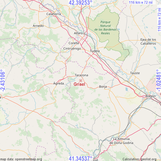
| Upper-left | 42.39253°, | -2.43106° |
| Center: | 41.87109°, | -1.72794° |
| Lower-right: | 41.34537°, | -1.02481° |
| Map W x H: | 116.4×116.4 km | = 72.3×72.3mi |
| max Lat: | 43.74134° ⇑29.7% North |
| Grisel: | 41.87109° |
| min Lat: | ⇓70.3% South 27.64134° |
| min Long | Grisel | max Long |
| -18.00367° | -1.72794° | 4.2899° |
| W 70.2%⇐ | ⇒29.8% E |
Elevation
Elevation of Grisel is 630 m = 2067 ft, and this is 32 m = 105 ft above average elevation for this country.
| Max E: |
1682 m = 5518 ft | 52.5% |
| Grisel | 630 m 2067 ft | |
| Avg. | 598 m = 1962 ft | |
Min E: |
0 m = 0 ft | 47.5% |
See also: Spain elevation on elevation.city.
Geographical zone
Grisel is located in North temperate zone (between Tropic of Cancer and the Arctic Circle). Distance of this Northern Tropic circle is 2049.7 km =1273.6 mi to South.| Distance of | km | miles | from Grisel |
|---|---|---|---|
| North Pole | 5351.4 | 3325.2 | to North |
| Arctic Circle | 2745.5 | 1706 | to North |
| Tropic Cancer | 2049.7 | 1273.6 | to South |
| Equator | 4655.6 | 2892.9 | to South |


Nearby cities:
15 places around Grisel: (largest is in red/bold)
• Alcalá de Moncayo
9.8 km =6.1 mi,  164°
164°
• Bulbuente
11.9 km =7.4 mi,  118°
118°
• Litago
6.7 km =4.2 mi,  197°
197°
• Lituénigo
4.9 km =3 mi,  215°
215°
• Malón
10.2 km =6.3 mi,  27°
27°
• Monteagudo
11.3 km =7 mi,  19°
19°
• Novallas
9.1 km =5.7 mi,  14°
14°
• Santa Cruz de Moncayo
2.7 km =1.7 mi,  298°
298°
• Tarazona
3.7 km =2.3 mi,  1°
1°
• Torrellas
4.4 km =2.7 mi,  305°
305°
• Trasmoz
5 km =3.1 mi,  175°
175°
• Tulebras
12.5 km =7.8 mi, 19°
• Vera de Moncayo
6.2 km =3.9 mi,  147°
147°
• Vierlas
7.3 km =4.5 mi, 31°
• Vozmediano
11.2 km =7 mi,  250°
250°
Sources, notices
• [Note1] Compared only with cities in Spain existing in our database
• [Src1] Map data: © OpenStreetMap contributors (CC-BY-SA)
• [Src2] Other city data from geonames.org with taken over terms of usage.
• [Src3] Geographical zone / Annual Mean Temperature by Robert A. Rohde @ Wikipedia
