Litago geodata
Litago (Aragon) is a seat of a third-order administrative division; located in Spain in Europe/Madrid (GMT+2) time zone. With population of 192 people, there are 5092 cities with bigger population in this country. Compared to other cities in Spain, 68.8% of cities are located further ↓South; 70% of cities are located further ←West and 66.8% of cities have lower elevation than Litago. Note1


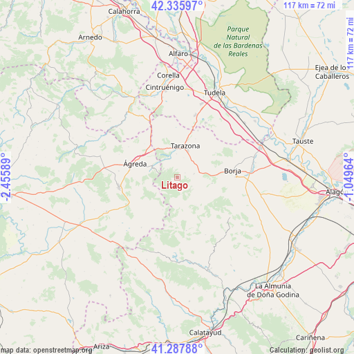
Litago GPS coordinates[2]
41° 48' 50.652" North, 1° 45' 9.936" West
| Map corner | latitude | longitude |
|---|---|---|
| Upper-left | 42.33597°, | -2.45589° |
| Center: | 41.81407°, | -1.75276° |
| Lower-right: | 41.28788°, | -1.04964° |
| Map W x H: | 116.5×116.5 km | = 72.4×72.4mi |
| max Lat: | 43.74134° ⇑31.2% North |
| Litago: | 41.81407° |
| min Lat: | ⇓68.8% South 27.64134° |
| min Long | Litago | max Long |
| -18.00367° | -1.75276° | 4.2899° |
| W 70%⇐ | ⇒30% E |
Elevation
Elevation of Litago is 790 m = 2592 ft, and this is 192 m = 630 ft above average elevation for this country.
| Max E: |
1682 m = 5518 ft | 33.2% |
| Litago | 790 m 2592 ft | |
| Avg. | 598 m = 1962 ft | |
Min E: |
0 m = 0 ft | 66.8% |
See also: Spain elevation on elevation.city.
Geographical zone
Litago is located in North temperate zone (between Tropic of Cancer and the Arctic Circle). Distance of this Northern Tropic circle is 2043.4 km =1269.7 mi to South.| Distance of | km | miles | from Litago |
|---|---|---|---|
| North Pole | 5357.8 | 3329.2 | to North |
| Arctic Circle | 2751.9 | 1710 | to North |
| Tropic Cancer | 2043.4 | 1269.7 | to South |
| Equator | 4649.3 | 2888.9 | to South |


Nearby cities:
15 places around Litago: (largest is in red/bold)
• Alcalá de Moncayo
5.7 km =3.5 mi,  123°
123°
• Ambel
11.6 km =7.2 mi,  100°
100°
• Beratón
11.8 km =7.3 mi,  204°
204°
• Bulbuente
12.5 km =7.8 mi,  87°
87°
• Cueva de Ágreda
12.6 km =7.8 mi,  243°
243°
• Grisel
6.7 km =4.2 mi,  17°
17°
• Lituénigo
2.5 km =1.6 mi,  342°
342°
• Santa Cruz de Moncayo
7.6 km =4.7 mi,  357°
357°
• Talamantes
11.1 km =6.9 mi,  146°
146°
• Tarazona
10.3 km =6.4 mi,  12°
12°
• Torrellas
9.1 km =5.7 mi,  350°
350°
• Trasmoz
2.8 km =1.7 mi,  61°
61°
• Vera de Moncayo
5.5 km =3.4 mi,  78°
78°
• Vierlas
13.9 km =8.6 mi,  25°
25°
• Vozmediano
8.9 km =5.5 mi,  286°
286°
Sources, notices
• [Note1] Compared only with cities in Spain existing in our database
• [Src1] Map data: © OpenStreetMap contributors (CC-BY-SA)
• [Src2] Other city data from geonames.org with taken over terms of usage.
• [Src3] Geographical zone / Annual Mean Temperature by Robert A. Rohde @ Wikipedia
