Vera de Moncayo geodata
Vera de Moncayo (Aragon) is a seat of a third-order administrative division; located in Spain in Europe/Madrid (GMT+2) time zone. With population of 419 people, there are 4081 cities with bigger population in this country. Compared to other cities in Spain, 69.1% of cities are located further ↓South; 70.8% of cities are located further ←West and 52.3% of cities have higher elevation than Vera de Moncayo. Note1


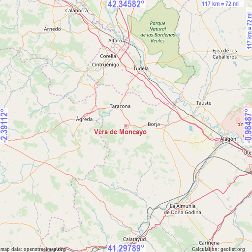
Vera de Moncayo GPS coordinates[2]
41° 49' 26.4" North, 1° 41' 16.764" West
| Map corner | latitude | longitude |
|---|---|---|
| Upper-left | 42.34582°, | -2.39112° |
| Center: | 41.824°, | -1.68799° |
| Lower-right: | 41.29789°, | -0.98487° |
| Map W x H: | 116.5×116.5 km | = 72.4×72.4mi |
| max Lat: | 43.74134° ⇑30.9% North |
| Vera de Moncayo: | 41.824° |
| min Lat: | ⇓69.1% South 27.64134° |
| min Long | Vera de Moncayo | max Long |
| -18.00367° | -1.68799° | 4.2899° |
| W 70.8%⇐ | ⇒29.2% E |
Elevation
Elevation of Vera de Moncayo is 633 m = 2077 ft, and this is 35 m = 115 ft above average elevation for this country.
| Max E: |
1682 m = 5518 ft | 52.3% |
| Vera de Moncayo | 633 m 2077 ft | |
| Avg. | 598 m = 1962 ft | |
Min E: |
0 m = 0 ft | 47.7% |
See also: Spain elevation on elevation.city.
Geographical zone
Vera de Moncayo is located in North temperate zone (between Tropic of Cancer and the Arctic Circle). Distance of this Northern Tropic circle is 2044.5 km =1270.4 mi to South.| Distance of | km | miles | from Vera de Moncayo |
|---|---|---|---|
| North Pole | 5356.7 | 3328.5 | to North |
| Arctic Circle | 2750.8 | 1709.3 | to North |
| Tropic Cancer | 2044.5 | 1270.4 | to South |
| Equator | 4650.4 | 2889.6 | to South |


Nearby cities:
15 places around Vera de Moncayo: (largest is in red/bold)
• Ainzón
13.9 km =8.6 mi,  93°
93°
• Alcalá de Moncayo
4.3 km =2.7 mi,  188°
188°
• Ambel
6.9 km =4.3 mi,  118°
118°
• Borja
12.9 km =8 mi, 85°
• Bulbuente
7.1 km =4.4 mi, 93°
• Grisel
6.2 km =3.9 mi,  327°
327°
• Litago
5.5 km =3.4 mi,  258°
258°
• Lituénigo
6.3 km =3.9 mi,  281°
281°
• Maleján
11.5 km =7.1 mi, 87°
• Santa Cruz de Moncayo
8.6 km =5.3 mi,  318°
318°
• Talamantes
10.4 km =6.5 mi,  175°
175°
• Tarazona
9.5 km =5.9 mi,  340°
340°
• Torrellas
10.4 km =6.5 mi, 318°
• Trasmoz
2.9 km =1.8 mi,  274°
274°
• Vierlas
11.5 km =7.1 mi,  2°
2°
Sources, notices
• [Note1] Compared only with cities in Spain existing in our database
• [Src1] Map data: © OpenStreetMap contributors (CC-BY-SA)
• [Src2] Other city data from geonames.org with taken over terms of usage.
• [Src3] Geographical zone / Annual Mean Temperature by Robert A. Rohde @ Wikipedia
