Lituénigo geodata
Lituénigo (Aragon) is a seat of a third-order administrative division; located in Spain in Europe/Madrid (GMT+2) time zone. With population of 124 people, there are 5647 cities with bigger population in this country. Compared to other cities in Spain, 69.5% of cities are located further ↓South; 69.9% of cities are located further ←West and 63.8% of cities have lower elevation than Lituénigo. Note1


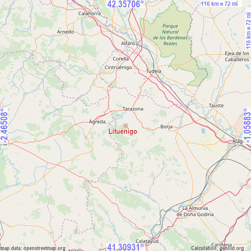
Lituénigo GPS coordinates[2]
41° 50' 7.188" North, 1° 45' 43.056" West
| Map corner | latitude | longitude |
|---|---|---|
| Upper-left | 42.35706°, | -2.46508° |
| Center: | 41.83533°, | -1.76196° |
| Lower-right: | 41.30931°, | -1.05883° |
| Map W x H: | 116.5×116.5 km | = 72.4×72.4mi |
| max Lat: | 43.74134° ⇑30.5% North |
| Lituénigo: | 41.83533° |
| min Lat: | ⇓69.5% South 27.64134° |
| min Long | Lituénigo | max Long |
| -18.00367° | -1.76196° | 4.2899° |
| W 69.9%⇐ | ⇒30.1% E |
Elevation
Elevation of Lituénigo is 770 m = 2526 ft, and this is 172 m = 564 ft above average elevation for this country.
| Max E: |
1682 m = 5518 ft | 36.2% |
| Lituénigo | 770 m 2526 ft | |
| Avg. | 598 m = 1962 ft | |
Min E: |
0 m = 0 ft | 63.8% |
See also: Spain elevation on elevation.city.
Geographical zone
Lituénigo is located in North temperate zone (between Tropic of Cancer and the Arctic Circle). Distance of this Northern Tropic circle is 2045.7 km =1271.1 mi to South.| Distance of | km | miles | from Lituénigo |
|---|---|---|---|
| North Pole | 5355.4 | 3327.7 | to North |
| Arctic Circle | 2749.5 | 1708.5 | to North |
| Tropic Cancer | 2045.7 | 1271.1 | to South |
| Equator | 4651.7 | 2890.4 | to South |


Nearby cities:
15 places around Lituénigo: (largest is in red/bold)
• Alcalá de Moncayo
7.8 km =4.8 mi,  134°
134°
• Ambel
13 km =8.1 mi,  110°
110°
• Bulbuente
13.3 km =8.3 mi,  97°
97°
• Cueva de Ágreda
13.2 km =8.2 mi,  232°
232°
• Grisel
4.9 km =3 mi,  35°
35°
• Litago
2.5 km =1.6 mi,  162°
162°
• Santa Cruz de Moncayo
5.3 km =3.3 mi,  5°
5°
• Talamantes
13.6 km =8.5 mi,  149°
149°
• Tarazona
8.3 km =5.2 mi,  20°
20°
• Torrellas
6.6 km =4.1 mi,  353°
353°
• Trasmoz
3.4 km =2.1 mi, 107°
• Vera de Moncayo
6.3 km =3.9 mi, 101°
• Vierlas
12.2 km =7.6 mi,  33°
33°
• Vozmediano
7.8 km =4.8 mi,  271°
271°
• Ágreda
13.5 km =8.4 mi,  279°
279°
Sources, notices
• [Note1] Compared only with cities in Spain existing in our database
• [Src1] Map data: © OpenStreetMap contributors (CC-BY-SA)
• [Src2] Other city data from geonames.org with taken over terms of usage.
• [Src3] Geographical zone / Annual Mean Temperature by Robert A. Rohde @ Wikipedia
