Grávalos geodata
Grávalos (La Rioja) is a seat of a third-order administrative division; located in Spain in Europe/Madrid (GMT+2) time zone. With population of 236 people, there are 4828 cities with bigger population in this country. Compared to other cities in Spain, 76.7% of cities are located further ↓South; 67.5% of cities are located further ←West and 59.1% of cities have lower elevation than Grávalos. Note1


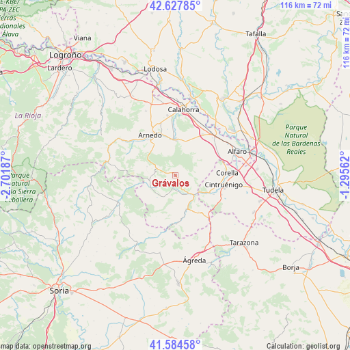
Grávalos GPS coordinates[2]
42° 6' 30.096" North, 1° 59' 55.464" West
| Map corner | latitude | longitude |
|---|---|---|
| Upper-left | 42.62785°, | -2.70187° |
| Center: | 42.10836°, | -1.99874° |
| Lower-right: | 41.58458°, | -1.29562° |
| Map W x H: | 116×116 km | = 72.1×72.1mi |
| max Lat: | 43.74134° ⇑23.3% North |
| Grávalos: | 42.10836° |
| min Lat: | ⇓76.7% South 27.64134° |
| min Long | Grávalos | max Long |
| -18.00367° | -1.99874° | 4.2899° |
| W 67.5%⇐ | ⇒32.5% E |
Elevation
Elevation of Grávalos is 738 m = 2421 ft, and this is 140 m = 459 ft above average elevation for this country.
| Max E: |
1682 m = 5518 ft | 40.9% |
| Grávalos | 738 m 2421 ft | |
| Avg. | 598 m = 1962 ft | |
Min E: |
0 m = 0 ft | 59.1% |
See also: Spain elevation on elevation.city.
Geographical zone
Grávalos is located in North temperate zone (between Tropic of Cancer and the Arctic Circle). Distance of this Northern Tropic circle is 2076.1 km =1290 mi to South.| Distance of | km | miles | from Grávalos |
|---|---|---|---|
| North Pole | 5325.1 | 3308.9 | to North |
| Arctic Circle | 2719.2 | 1689.6 | to North |
| Tropic Cancer | 2076.1 | 1290 | to South |
| Equator | 4682 | 2909.3 | to South |


Nearby cities:
15 places around Grávalos: (largest is in red/bold)
• Aguilar del Río Alhama
16.3 km =10.1 mi,  178°
178°
• Aldeanueva de Ebro
16.3 km =10.1 mi,  34°
34°
• Arnedo
15.7 km =9.8 mi,  327°
327°
• Autol
12 km =7.5 mi,  357°
357°
• Cervera del Río Alhama
12 km =7.5 mi,  162°
162°
• Cintruénigo
16.3 km =10.1 mi,  101°
101°
• Corella
17.6 km =10.9 mi,  87°
87°
• Cornago
9.3 km =5.8 mi,  238°
238°
• Fitero
12.9 km =8 mi,  115°
115°
• Igea
4.6 km =2.9 mi,  192°
192°
• Muro de Aguas
9.7 km =6 mi,  286°
286°
• Préjano
17.3 km =10.7 mi,  300°
300°
• Quel
14.2 km =8.8 mi,  342°
342°
• Valdemadera
15.2 km =9.4 mi,  204°
204°
• Villarroya
6.3 km =3.9 mi, 293°
Sources, notices
• [Note1] Compared only with cities in Spain existing in our database
• [Src1] Map data: © OpenStreetMap contributors (CC-BY-SA)
• [Src2] Other city data from geonames.org with taken over terms of usage.
• [Src3] Geographical zone / Annual Mean Temperature by Robert A. Rohde @ Wikipedia
