Eibar geodata
Eibar (Basque Country) is a seat of a third-order administrative division; located in Spain in Europe/Madrid (GMT+2) time zone. With population of 27,419 people, there are 339 cities with bigger population in this country. Compared to other cities in Spain, 96.3% of cities are located further ↓South; 61.3% of cities are located further ←West and 85.3% of cities have higher elevation than Eibar. Note1


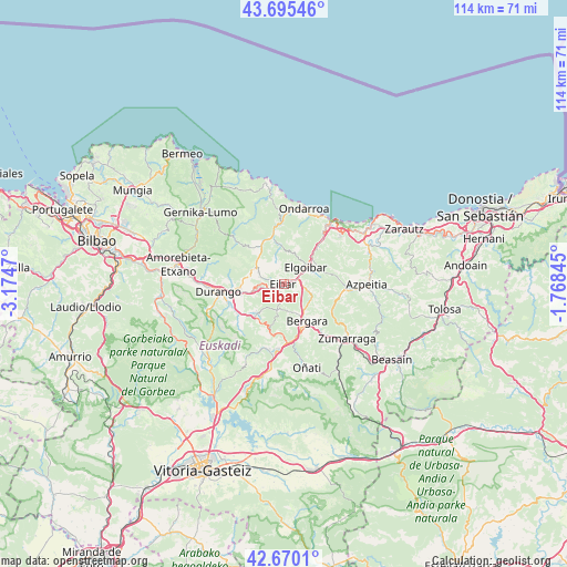
Eibar GPS coordinates[2]
43° 11' 5.748" North, 2° 28' 17.688" West
| Map corner | latitude | longitude |
|---|---|---|
| Upper-left | 43.69546°, | -3.1747° |
| Center: | 43.18493°, | -2.47158° |
| Lower-right: | 42.6701°, | -1.76845° |
| Map W x H: | 114×114 km | = 70.8×70.8mi |
| max Lat: | 43.74134° ⇑3.7% North |
| Eibar: | 43.18493° |
| min Lat: | ⇓96.3% South 27.64134° |
| min Long | Eibar | max Long |
| -18.00367° | -2.47158° | 4.2899° |
| W 61.3%⇐ | ⇒38.7% E |
Elevation
Elevation of Eibar is 133 m = 436 ft, and this is 465 m = 1526 ft below average elevation for this country.
| Max E: |
1682 m = 5518 ft | 85.3% |
| Avg. | 598 m = 1962 ft | |
| Eibar | 133 m = 436 ft | |
Min E: |
0 m = 0 ft | 14.7% |
See also: Spain elevation on elevation.city.
Geographical zone
Eibar is located in North temperate zone (between Tropic of Cancer and the Arctic Circle). Distance of this Northern Tropic circle is 2195.8 km =1364.4 mi to South.| Distance of | km | miles | from Eibar |
|---|---|---|---|
| North Pole | 5205.3 | 3234.4 | to North |
| Arctic Circle | 2599.5 | 1615.3 | to North |
| Tropic Cancer | 2195.8 | 1364.4 | to South |
| Equator | 4801.7 | 2983.6 | to South |


Nearby cities:
15 places around Eibar: (largest is in red/bold)
• Abadiño
11.8 km =7.3 mi,  251°
251°
• Antzuola
12.3 km =7.6 mi,  142°
142°
• Azkoitia
13 km =8.1 mi,  93°
93°
• Bergara
8.9 km =5.5 mi,  150°
150°
• Berriz
8 km =5 mi,  255°
255°
• Durango
13.2 km =8.2 mi, 263°
• Elgeta
5.5 km =3.4 mi,  194°
194°
• Elgoibar
5.9 km =3.7 mi,  53°
53°
• Elorrio
8.3 km =5.2 mi,  222°
222°
• Ermua
2.5 km =1.6 mi,  275°
275°
• Etxebarria
7.7 km =4.8 mi,  356°
356°
• Iurreta
13.1 km =8.1 mi,  269°
269°
• Markina-Xemein
9.4 km =5.8 mi,  345°
345°
• Mendaro
10.3 km =6.4 mi,  42°
42°
• Zaldibar
5.4 km =3.4 mi, 247°
Sources, notices
• [Note1] Compared only with cities in Spain existing in our database
• [Src1] Map data: © OpenStreetMap contributors (CC-BY-SA)
• [Src2] Other city data from geonames.org with taken over terms of usage.
• [Src3] Geographical zone / Annual Mean Temperature by Robert A. Rohde @ Wikipedia
