Costur geodata
Costur (Valencia) is a seat of a third-order administrative division; located in Spain in Europe/Madrid (GMT+2) time zone. With population of 474 people, there are 3951 cities with bigger population in this country. Compared to other cities in Spain, 68.4% of cities are located further ↑North; 85.8% of cities are located further ←West and 64.1% of cities have higher elevation than Costur. Note1


Costur GPS coordinates[2]
40° 7' 10.956" North, 0° 10' 25.86" West
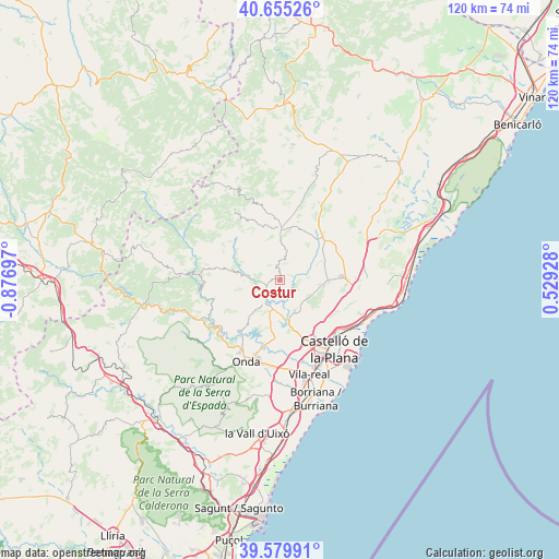
| Map corner | latitude | longitude |
|---|---|---|
| Upper-left | 40.65526°, | -0.87697° |
| Center: | 40.11971°, | -0.17385° |
| Lower-right: | 39.57991°, | 0.52928° |
| Map W x H: | 119.6×119.6 km | = 74.3×74.3mi |
| max Lat: | 43.74134° ⇑68.4% North |
| Costur: | 40.11971° |
| min Lat: | ⇓31.6% South 27.64134° |
| min Long | Costur | max Long |
| -18.00367° | -0.17385° | 4.2899° |
| W 85.8%⇐ | ⇒14.2% E |
Elevation
Elevation of Costur is 472 m = 1549 ft, and this is 126 m = 413 ft below average elevation for this country.
| Max E: |
1682 m = 5518 ft | 64.1% |
| Avg. | 598 m = 1962 ft | |
| Costur | 472 m = 1549 ft | |
Min E: |
0 m = 0 ft | 35.9% |
See also: Spain elevation on elevation.city.
Geographical zone
Costur is located in North temperate zone (between Tropic of Cancer and the Arctic Circle). Distance of this Northern Tropic circle is 1855 km =1152.6 mi to South.| Distance of | km | miles | from Costur |
|---|---|---|---|
| North Pole | 5546.2 | 3446.2 | to North |
| Arctic Circle | 2940.3 | 1827 | to North |
| Tropic Cancer | 1855 | 1152.6 | to South |
| Equator | 4460.9 | 2771.9 | to South |


Nearby cities:
15 places around Costur: (largest is in red/bold)
• Adzaneta
10.7 km =6.6 mi,  1°
1°
• Argelita
16.9 km =10.5 mi,  242°
242°
• Benafigos
17.7 km =11 mi,  350°
350°
• Borriol
12.3 km =7.6 mi,  134°
134°
• Espadilla
17.8 km =11.1 mi, 237°
• Fanzara
16.7 km =10.4 mi,  226°
226°
• Figueroles
5.1 km =3.2 mi,  266°
266°
• Lucena del Cid
9.4 km =5.8 mi,  279°
279°
• Ludiente
16.9 km =10.5 mi,  256°
256°
• Puebla Tornesa
14.8 km =9.2 mi,  97°
97°
• Ribesalbes
13.9 km =8.6 mi,  214°
214°
• San Juan de Moró
7.4 km =4.6 mi,  154°
154°
• Useras
4.3 km =2.7 mi,  9°
9°
• Villafamés
10.5 km =6.5 mi,  91°
91°
• l'Alcora
6.3 km =3.9 mi,  200°
200°
Sources, notices
• [Note1] Compared only with cities in Spain existing in our database
• [Src1] Map data: © OpenStreetMap contributors (CC-BY-SA)
• [Src2] Other city data from geonames.org with taken over terms of usage.
• [Src3] Geographical zone / Annual Mean Temperature by Robert A. Rohde @ Wikipedia
