Useras geodata
Useras (Valencia) is a populated place; located in Spain in Europe/Madrid (GMT+2) time zone. With population of 990 people, there are 2966 cities with bigger population in this country. Compared to other cities in Spain, 67.8% of cities are located further ↑North; 85.9% of cities are located further ←West and 68.9% of cities have higher elevation than Useras. Note1
Administrative division(s):
- Level 1: Valencia
- Level 2: Província de Castelló
- Level 3: Useras/Useres, les


Useras GPS coordinates[2]
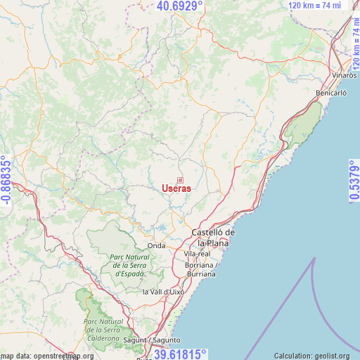
40° 9' 27.54" North, 0° 9' 54.792" West
| Map corner | latitude | longitude |
|---|---|---|
| Upper-left | 40.6929°, | -0.86835° |
| Center: | 40.15765°, | -0.16522° |
| Lower-right: | 39.61815°, | 0.5379° |
| Map W x H: | 119.5×119.5 km | = 74.3×74.3mi |
| max Lat: | 43.74134° ⇑67.8% North |
| Useras: | 40.15765° |
| min Lat: | ⇓32.2% South 27.64134° |
| min Long | Useras | max Long |
| -18.00367° | -0.16522° | 4.2899° |
| W 85.9%⇐ | ⇒14.1% E |
Elevation
Elevation of Useras is 401 m = 1316 ft, and this is 197 m = 646 ft below average elevation for this country.
| Max E: |
1682 m = 5518 ft | 68.9% |
| Avg. | 598 m = 1962 ft | |
| Useras | 401 m = 1316 ft | |
Min E: |
0 m = 0 ft | 31.1% |
See also: Spain elevation on elevation.city.
Geographical zone
Useras is located in North temperate zone (between Tropic of Cancer and the Arctic Circle). Distance of this Northern Tropic circle is 1859.2 km =1155.3 mi to South.| Distance of | km | miles | from Useras |
|---|---|---|---|
| North Pole | 5541.9 | 3443.6 | to North |
| Arctic Circle | 2936.1 | 1824.4 | to North |
| Tropic Cancer | 1859.2 | 1155.3 | to South |
| Equator | 4465.1 | 2774.5 | to South |


Nearby cities:
15 places around Useras: (largest is in red/bold)
• Adzaneta
6.5 km =4 mi,  356°
356°
• Benafigos
13.7 km =8.5 mi,  344°
344°
• Benlloch
17.4 km =10.8 mi,  70°
70°
• Borriol
15.1 km =9.4 mi,  147°
147°
• Cabanes
17.7 km =11 mi,  90°
90°
• Castillo de Villamalefa
18.7 km =11.6 mi,  261°
261°
• Costur
4.3 km =2.7 mi,  189°
189°
• Figueroles
7.4 km =4.6 mi,  231°
231°
• Lucena del Cid
10.4 km =6.5 mi,  254°
254°
• Puebla Tornesa
15.2 km =9.4 mi,  113°
113°
• Ribesalbes
17.9 km =11.1 mi,  208°
208°
• San Juan de Moró
11.1 km =6.9 mi,  167°
167°
• Sierra-Engarcerán
17.6 km =10.9 mi,  45°
45°
• Villafamés
10.8 km =6.7 mi, 114°
• l'Alcora
10.5 km =6.5 mi,  196°
196°
Sources, notices
• [Note1] Compared only with cities in Spain existing in our database
• [Src1] Map data: © OpenStreetMap contributors (CC-BY-SA)
• [Src2] Other city data from geonames.org with taken over terms of usage.
• [Src3] Geographical zone / Annual Mean Temperature by Robert A. Rohde @ Wikipedia
