Cosa geodata
Cosa (Aragon) is a seat of a third-order administrative division; located in Spain in Europe/Madrid (GMT+2) time zone. With population of 98 people, there are 5963 cities with bigger population in this country. Compared to other cities in Spain, 55.4% of cities are located further ↑North; 76.1% of cities are located further ←West and 96.6% of cities have lower elevation than Cosa. Note1


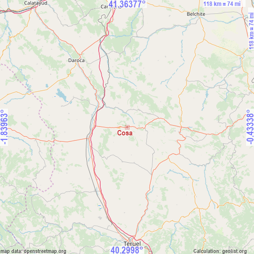
Cosa GPS coordinates[2]
40° 50' 2.112" North, 1° 8' 11.4" West
| Map corner | latitude | longitude |
|---|---|---|
| Upper-left | 41.36377°, | -1.83963° |
| Center: | 40.83392°, | -1.1365° |
| Lower-right: | 40.2998°, | -0.43338° |
| Map W x H: | 118.3×118.3 km | = 73.5×73.5mi |
| max Lat: | 43.74134° ⇑55.4% North |
| Cosa: | 40.83392° |
| min Lat: | ⇓44.6% South 27.64134° |
| min Long | Cosa | max Long |
| -18.00367° | -1.1365° | 4.2899° |
| W 76.1%⇐ | ⇒23.9% E |
Elevation
Elevation of Cosa is 1193 m = 3914 ft, and this is 595 m = 1952 ft above average elevation for this country.
| Max E: |
1682 m = 5518 ft | 3.4% |
| Cosa | 1193 m 3914 ft | |
| Avg. | 598 m = 1962 ft | |
Min E: |
0 m = 0 ft | 96.6% |
See also: Spain elevation on elevation.city.
Geographical zone
Cosa is located in North temperate zone (between Tropic of Cancer and the Arctic Circle). Distance of this Northern Tropic circle is 1934.4 km =1202 mi to South.| Distance of | km | miles | from Cosa |
|---|---|---|---|
| North Pole | 5466.8 | 3396.9 | to North |
| Arctic Circle | 2860.9 | 1777.7 | to North |
| Tropic Cancer | 1934.4 | 1202 | to South |
| Equator | 4540.3 | 2821.2 | to South |


Nearby cities:
15 places around Cosa: (largest is in red/bold)
• Alpeñés
7 km =4.3 mi,  122°
122°
• Argente
16.3 km =10.1 mi,  187°
187°
• Barrachina
7 km =4.3 mi,  358°
358°
• Bañón
4.6 km =2.9 mi,  276°
276°
• Calamocha
16.5 km =10.3 mi,  305°
305°
• Caminreal
15.8 km =9.8 mi,  271°
271°
• Fuenferrada
11.2 km =7 mi,  69°
69°
• Fuentes Claras
16 km =9.9 mi, 281°
• Lidón
13.1 km =8.1 mi,  171°
171°
• Pancrudo
12 km =7.5 mi,  131°
131°
• Rubielos de la Cérida
9.5 km =5.9 mi,  222°
222°
• Torre los Negros
3.9 km =2.4 mi,  56°
56°
• Torrecilla del Rebollar
10 km =6.2 mi,  32°
32°
• Villanueva del Rebollar de la Sierra
12.5 km =7.8 mi, 59°
• Visiedo
16.8 km =10.4 mi, 168°
Sources, notices
• [Note1] Compared only with cities in Spain existing in our database
• [Src1] Map data: © OpenStreetMap contributors (CC-BY-SA)
• [Src2] Other city data from geonames.org with taken over terms of usage.
• [Src3] Geographical zone / Annual Mean Temperature by Robert A. Rohde @ Wikipedia
