Castrelo de Miño geodata
Castrelo de Miño (Galicia) is a seat of a third-order administrative division; located in Spain in Europe/Madrid (GMT+2) time zone. With population of 2,033 people, there are 2142 cities with bigger population in this country. Compared to other cities in Spain, 81.7% of cities are located further ↓South; 96.5% of cities are located further →East and 80.1% of cities have higher elevation than Castrelo de Miño. Note1
Administrative division(s):
- Level 1: Galicia
- Level 2: Provincia de Ourense
- Level 3: Castrelo de Miño


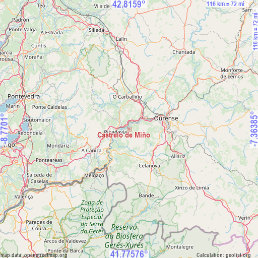
Castrelo de Miño GPS coordinates[2]
42° 17' 52.728" North, 8° 4' 1.092" West
| Map corner | latitude | longitude |
|---|---|---|
| Upper-left | 42.8159°, | -8.7701° |
| Center: | 42.29798°, | -8.06697° |
| Lower-right: | 41.77576°, | -7.36385° |
| Map W x H: | 115.7×115.7 km | = 71.9×71.9mi |
| max Lat: | 43.74134° ⇑18.3% North |
| Castrelo de Miño: | 42.29798° |
| min Lat: | ⇓81.7% South 27.64134° |
| min Long | Castrelo de Mi� | max Long |
| -18.00367° | -8.06697° | 4.2899° |
| W 3.5%⇐ | ⇒96.5% E |
Elevation
Elevation of Castrelo de Miño is 218 m = 715 ft, and this is 380 m = 1247 ft below average elevation for this country.
| Max E: |
1682 m = 5518 ft | 80.1% |
| Avg. | 598 m = 1962 ft | |
| Castrelo de Miño | 218 m = 715 ft | |
Min E: |
0 m = 0 ft | 19.9% |
See also: Spain elevation on elevation.city.
Geographical zone
Castrelo de Miño is located in North temperate zone (between Tropic of Cancer and the Arctic Circle). Distance of this Northern Tropic circle is 2097.2 km =1303.1 mi to South.| Distance of | km | miles | from Castrelo de Miño |
|---|---|---|---|
| North Pole | 5304 | 3295.8 | to North |
| Arctic Circle | 2698.1 | 1676.5 | to North |
| Tropic Cancer | 2097.2 | 1303.1 | to South |
| Equator | 4703.1 | 2922.4 | to South |


Nearby cities:
15 places around Castrelo de Miño: (largest is in red/bold)
• Amoeiro
16.3 km =10.1 mi,  36°
36°
• Beade
6.3 km =3.9 mi,  305°
305°
• Boborás
16.3 km =10.1 mi,  337°
337°
• Carballeda de Avia
8.4 km =5.2 mi,  287°
287°
• Cartelle
5.2 km =3.2 mi,  183°
183°
• Cenlle
5.2 km =3.2 mi, 338°
• Cortegada
12.9 km =8 mi,  220°
220°
• Maside
12.9 km =8 mi,  15°
15°
• Melón
12.8 km =8 mi,  250°
250°
• O Carballiño
14.9 km =9.3 mi,  356°
356°
• Ourense
17.2 km =10.7 mi,  75°
75°
• Punxín
9.3 km =5.8 mi,  29°
29°
• Ribadavia
6.4 km =4 mi,  260°
260°
• San Amaro
8.5 km =5.3 mi, 356°
• Toén
9.5 km =5.9 mi, 76°
Sources, notices
• [Note1] Compared only with cities in Spain existing in our database
• [Src1] Map data: © OpenStreetMap contributors (CC-BY-SA)
• [Src2] Other city data from geonames.org with taken over terms of usage.
• [Src3] Geographical zone / Annual Mean Temperature by Robert A. Rohde @ Wikipedia
