Castelló de Farfanya geodata
Castelló de Farfanya (Catalonia) is a seat of a third-order administrative division; located in Spain in Europe/Madrid (GMT+2) time zone. In our database, there are 6762 cities with bigger population. Compared to other cities in Spain, 68.9% of cities are located further ↓South; 89.7% of cities are located further ←West and 72.6% of cities have higher elevation than Castelló de Farfanya. Note1
Administrative division(s):
- Level 1: Catalonia
- Level 2: Província de Lleida
- Level 3: Castelló de Farfanya


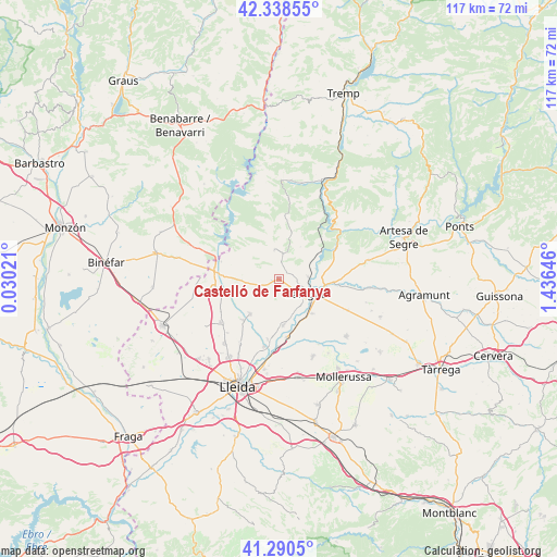
Castelló de Farfanya GPS coordinates[2]
41° 49' 0.012" North, 0° 43' 59.988" East
| Map corner | latitude | longitude |
|---|---|---|
| Upper-left | 42.33855°, | 0.03021° |
| Center: | 41.81667°, | 0.73333° |
| Lower-right: | 41.2905°, | 1.43646° |
| Map W x H: | 116.5×116.5 km | = 72.4×72.4mi |
| max Lat: | 43.74134° ⇑31.1% North |
| Castelló de Farfanya: | 41.81667° |
| min Lat: | ⇓68.9% South 27.64134° |
| min Long | Castelló de Fa | max Long |
| -18.00367° | 0.73333° | 4.2899° |
| W 89.7%⇐ | ⇒10.3% E |
Elevation
Elevation of Castelló de Farfanya is 337 m = 1106 ft, and this is 261 m = 856 ft below average elevation for this country.
| Max E: |
1682 m = 5518 ft | 72.6% |
| Avg. | 598 m = 1962 ft | |
| Castelló de Farfanya | 337 m = 1106 ft | |
Min E: |
0 m = 0 ft | 27.4% |
See also: Spain elevation on elevation.city.
Geographical zone
Castelló de Farfanya is located in North temperate zone (between Tropic of Cancer and the Arctic Circle). Distance of this Northern Tropic circle is 2043.7 km =1269.9 mi to South.| Distance of | km | miles | from Castelló de Farfanya |
|---|---|---|---|
| North Pole | 5357.5 | 3329 | to North |
| Arctic Circle | 2751.6 | 1709.8 | to North |
| Tropic Cancer | 2043.7 | 1269.9 | to South |
| Equator | 4649.6 | 2889.1 | to South |


Nearby cities:
15 places around Castelló de Farfanya: (largest is in red/bold)
• Albesa
9.4 km =5.8 mi,  220°
220°
• Alfarràs
12.4 km =7.7 mi,  270°
270°
• Algerri
8 km =5 mi, 268°
• Alguaire
15.2 km =9.4 mi,  234°
234°
• Almenar
13.9 km =8.6 mi,  260°
260°
• Balaguer
7 km =4.3 mi,  113°
113°
• Bellcaire d'Urgell
16.9 km =10.5 mi,  115°
115°
• Bellvís
17.5 km =10.9 mi,  156°
156°
• Camarasa
13.6 km =8.5 mi,  61°
61°
• Corbins
15.1 km =9.4 mi,  190°
190°
• Menàrguens
9.4 km =5.8 mi,  171°
171°
• Os de Balaguer
6.4 km =4 mi,  350°
350°
• Térmens
11.5 km =7.1 mi, 166°
• Vallfogona de Balaguer
9.8 km =6.1 mi,  137°
137°
• Vilanova de Segrià
14.7 km =9.1 mi, 221°
Sources, notices
• [Note1] Compared only with cities in Spain existing in our database
• [Src1] Map data: © OpenStreetMap contributors (CC-BY-SA)
• [Src2] Other city data from geonames.org with taken over terms of usage.
• [Src3] Geographical zone / Annual Mean Temperature by Robert A. Rohde @ Wikipedia
