Casas de Don Gómez geodata
Casas de Don Gómez (Extremadura) is a seat of a third-order administrative division; located in Spain in Europe/Madrid (GMT+2) time zone. With population of 353 people, there are 4306 cities with bigger population in this country. Compared to other cities in Spain, 70.1% of cities are located further ↑North; 91.9% of cities are located further →East and 73.5% of cities have higher elevation than Casas de Don Gómez. Note1
Administrative division(s):
- Level 1: Extremadura
- Level 2: Provincia de Cáceres
- Level 3: Casas de Don Gómez


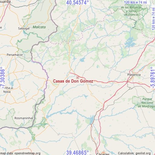
Casas de Don Gómez GPS coordinates[2]
40° 0' 33.552" North, 6° 36' 2.628" West
| Map corner | latitude | longitude |
|---|---|---|
| Upper-left | 40.54574°, | -7.30386° |
| Center: | 40.00932°, | -6.60073° |
| Lower-right: | 39.46865°, | -5.89761° |
| Map W x H: | 119.8×119.8 km | = 74.4×74.4mi |
| max Lat: | 43.74134° ⇑70.1% North |
| Casas de Don Gómez: | 40.00932° |
| min Lat: | ⇓29.9% South 27.64134° |
| min Long | Casas de Don G� | max Long |
| -18.00367° | -6.60073° | 4.2899° |
| W 8.1%⇐ | ⇒91.9% E |
Elevation
Elevation of Casas de Don Gómez is 324 m = 1063 ft, and this is 274 m = 899 ft below average elevation for this country.
| Max E: |
1682 m = 5518 ft | 73.5% |
| Avg. | 598 m = 1962 ft | |
| Casas de Don Gómez | 324 m = 1063 ft | |
Min E: |
0 m = 0 ft | 26.5% |
See also: Spain elevation on elevation.city.
Geographical zone
Casas de Don Gómez is located in North temperate zone (between Tropic of Cancer and the Arctic Circle). Distance of this Northern Tropic circle is 1842.7 km =1145 mi to South.| Distance of | km | miles | from Casas de Don Gómez |
|---|---|---|---|
| North Pole | 5558.4 | 3453.8 | to North |
| Arctic Circle | 2952.6 | 1834.7 | to North |
| Tropic Cancer | 1842.7 | 1145 | to South |
| Equator | 4448.6 | 2764.2 | to South |


Nearby cities:
15 places around Casas de Don Gómez: (largest is in red/bold)
• Cachorrilla
11.9 km =7.4 mi,  209°
209°
• Calzadilla
8.1 km =5 mi,  45°
45°
• Casillas de Coria
5.8 km =3.6 mi, 212°
• Coria
6.2 km =3.9 mi,  117°
117°
• Guijo de Coria
15.5 km =9.6 mi, 48°
• Guijo de Galisteo
18.8 km =11.7 mi,  59°
59°
• Huélaga
5.3 km =3.3 mi,  346°
346°
• Moraleja
8.1 km =5 mi,  321°
321°
• Morcillo
17.3 km =10.7 mi,  86°
86°
• Perales del Puerto
17.7 km =11 mi,  337°
337°
• Pescueza
10.9 km =6.8 mi,  200°
200°
• Portaje
10.7 km =6.6 mi,  162°
162°
• Santibáñez el Alto
20.1 km =12.5 mi,  12°
12°
• Torrejoncillo
16.9 km =10.5 mi,  137°
137°
• Villasbuenas de Gata
19 km =11.8 mi, 353°
Sources, notices
• [Note1] Compared only with cities in Spain existing in our database
• [Src1] Map data: © OpenStreetMap contributors (CC-BY-SA)
• [Src2] Other city data from geonames.org with taken over terms of usage.
• [Src3] Geographical zone / Annual Mean Temperature by Robert A. Rohde @ Wikipedia
