Cadrete geodata
Cadrete (Aragon) is a seat of a third-order administrative division; located in Spain in Europe/Madrid (GMT+2) time zone. With population of 2,296 people, there are 2002 cities with bigger population in this country. Compared to other cities in Spain, 62.3% of cities are located further ↓South; 77.5% of cities are located further ←West and 74.5% of cities have higher elevation than Cadrete. Note1


Cadrete GPS coordinates[2]
41° 33' 20.7" North, 0° 57' 36.468" West
| Map corner | latitude | longitude |
|---|---|---|
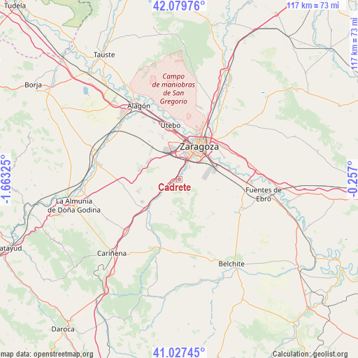
| Upper-left | 42.07976°, | -1.66325° |
| Center: | 41.55575°, | -0.96013° |
| Lower-right: | 41.02745°, | -0.257° |
| Map W x H: | 117×117 km | = 72.7×72.7mi |
| max Lat: | 43.74134° ⇑37.7% North |
| Cadrete: | 41.55575° |
| min Lat: | ⇓62.3% South 27.64134° |
| min Long | Cadrete | max Long |
| -18.00367° | -0.96013° | 4.2899° |
| W 77.5%⇐ | ⇒22.5% E |
Elevation
Elevation of Cadrete is 304 m = 997 ft, and this is 294 m = 965 ft below average elevation for this country.
| Max E: |
1682 m = 5518 ft | 74.5% |
| Avg. | 598 m = 1962 ft | |
| Cadrete | 304 m = 997 ft | |
Min E: |
0 m = 0 ft | 25.5% |
See also: Spain elevation on elevation.city.
Geographical zone
Cadrete is located in North temperate zone (between Tropic of Cancer and the Arctic Circle). Distance of this Northern Tropic circle is 2014.6 km =1251.8 mi to South.| Distance of | km | miles | from Cadrete |
|---|---|---|---|
| North Pole | 5386.5 | 3347 | to North |
| Arctic Circle | 2780.6 | 1727.8 | to North |
| Tropic Cancer | 2014.6 | 1251.8 | to South |
| Equator | 4620.6 | 2871.1 | to South |


Nearby cities:
15 places around Cadrete: (largest is in red/bold)
• Almozara
12.7 km =7.9 mi,  22°
22°
• Botorrita
8 km =5 mi,  227°
227°
• Cuarte de Huerva
4.9 km =3 mi,  27°
27°
• Delicias
11.3 km =7 mi, 22°
• El Burgo de Ebro
18.3 km =11.4 mi,  84°
84°
• Jaulín
11.8 km =7.3 mi,  193°
193°
• María de Huerva
3.5 km =2.2 mi,  237°
237°
• Mezalocha
17.7 km =11 mi,  215°
215°
• Montecanal
8.4 km =5.2 mi,  12°
12°
• Mozota
12 km =7.5 mi, 228°
• Muel
14.4 km =8.9 mi, 226°
• Oliver-Valdefierro
10.1 km =6.3 mi, 12°
• Utebo
17.3 km =10.7 mi,  349°
349°
• Valmadrid
14 km =8.7 mi,  153°
153°
• Zaragoza
13.1 km =8.1 mi, 31°
Sources, notices
• [Note1] Compared only with cities in Spain existing in our database
• [Src1] Map data: © OpenStreetMap contributors (CC-BY-SA)
• [Src2] Other city data from geonames.org with taken over terms of usage.
• [Src3] Geographical zone / Annual Mean Temperature by Robert A. Rohde @ Wikipedia
