Castejón del Puente geodata
Castejón del Puente (Aragon) is a seat of a third-order administrative division; located in Spain in Europe/Madrid (GMT+2) time zone. With population of 447 people, there are 4012 cities with bigger population in this country. Compared to other cities in Spain, 72.6% of cities are located further ↓South; 87.8% of cities are located further ←West and 71.4% of cities have higher elevation than Castejón del Puente. Note1
Administrative division(s):
- Level 1: Aragon
- Level 2: Provincia de Huesca
- Level 3: Castejón del Puente


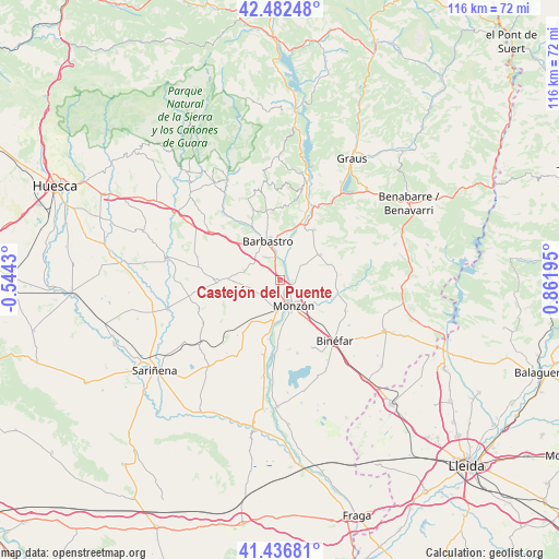
Castejón del Puente GPS coordinates[2]
41° 57' 42.444" North, 0° 9' 31.788" East
| Map corner | latitude | longitude |
|---|---|---|
| Upper-left | 42.48248°, | -0.5443° |
| Center: | 41.96179°, | 0.15883° |
| Lower-right: | 41.43681°, | 0.86195° |
| Map W x H: | 116.3×116.3 km | = 72.3×72.3mi |
| max Lat: | 43.74134° ⇑27.4% North |
| Castejón del Puente: | 41.96179° |
| min Lat: | ⇓72.6% South 27.64134° |
| min Long | Castejón del P | max Long |
| -18.00367° | 0.15883° | 4.2899° |
| W 87.8%⇐ | ⇒12.2% E |
Elevation
Elevation of Castejón del Puente is 358 m = 1175 ft, and this is 240 m = 787 ft below average elevation for this country.
| Max E: |
1682 m = 5518 ft | 71.4% |
| Avg. | 598 m = 1962 ft | |
| Castejón del Puente | 358 m = 1175 ft | |
Min E: |
0 m = 0 ft | 28.6% |
See also: Spain elevation on elevation.city.
Geographical zone
Castejón del Puente is located in North temperate zone (between Tropic of Cancer and the Arctic Circle). Distance of this Northern Tropic circle is 2059.8 km =1279.9 mi to South.| Distance of | km | miles | from Castejón del Puente |
|---|---|---|---|
| North Pole | 5341.3 | 3318.9 | to North |
| Arctic Circle | 2735.5 | 1699.8 | to North |
| Tropic Cancer | 2059.8 | 1279.9 | to South |
| Equator | 4665.7 | 2899.1 | to South |


Nearby cities:
15 places around Castejón del Puente: (largest is in red/bold)
• Alfántega
14.9 km =9.3 mi,  183°
183°
• Barbastro
8.6 km =5.3 mi,  342°
342°
• Berbegal
13.4 km =8.3 mi,  268°
268°
• Binaced
15.5 km =9.6 mi,  167°
167°
• Binéfar
16.6 km =10.3 mi,  137°
137°
• Castillazuelo
14.1 km =8.8 mi,  326°
326°
• Estada
13.7 km =8.5 mi,  26°
26°
• Estadilla
12.6 km =7.8 mi, 33°
• Fonz
9.9 km =6.2 mi,  56°
56°
• Ilche
8.4 km =5.2 mi, 266°
• Monzón
6.4 km =4 mi,  152°
152°
• Pozán de Vero
17.1 km =10.6 mi,  321°
321°
• Pueyo de Santa Cruz
11.5 km =7.1 mi, 180°
• Salas Bajas
16.6 km =10.3 mi, 338°
• San Esteban de Litera (Sant Esteve de Llitera)
15.3 km =9.5 mi,  114°
114°
Sources, notices
• [Note1] Compared only with cities in Spain existing in our database
• [Src1] Map data: © OpenStreetMap contributors (CC-BY-SA)
• [Src2] Other city data from geonames.org with taken over terms of usage.
• [Src3] Geographical zone / Annual Mean Temperature by Robert A. Rohde @ Wikipedia
