Arroyo de la Encomienda geodata
Arroyo de la Encomienda (Castille and León) is a populated place; located in Spain in Europe/Madrid (GMT+2) time zone. With population of 11,716 people, there are 759 cities with bigger population in this country. Compared to other cities in Spain, 63.6% of cities are located further ↓South; 69.7% of cities are located further →East and 53% of cities have lower elevation than Arroyo de la Encomienda. Note1
Administrative division(s):
- Level 1: Castille and León
- Level 2: Provincia de Valladolid
- Level 3: Arroyo de la Encomienda
Current local time in Arroyo de la Encomienda:
10:48 PM, ThursdayDifference from your time zone: hours


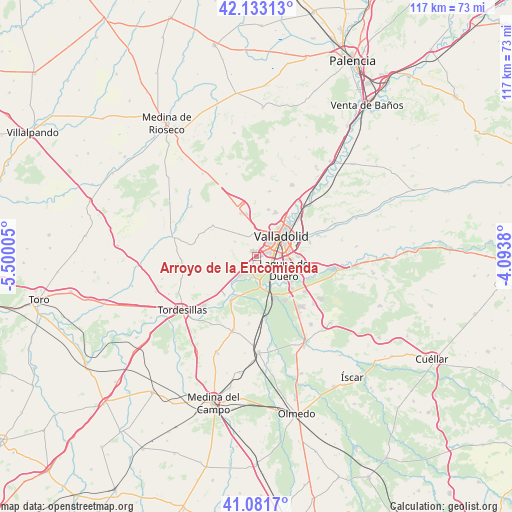
Arroyo de la Encomienda GPS coordinates[2]
41° 36' 34.416" North, 4° 47' 48.912" West
| Map corner | latitude | longitude |
|---|---|---|
| Upper-left | 42.13313°, | -5.50005° |
| Center: | 41.60956°, | -4.79692° |
| Lower-right: | 41.0817°, | -4.0938° |
| Map W x H: | 116.9×116.9 km | = 72.6×72.6mi |
| max Lat: | 43.74134° ⇑36.4% North |
| Arroyo de la Encomienda: | 41.60956° |
| min Lat: | ⇓63.6% South 27.64134° |
| min Long | Arroyo de la En | max Long |
| -18.00367° | -4.79692° | 4.2899° |
| W 30.3%⇐ | ⇒69.7% E |
Elevation
Elevation of Arroyo de la Encomienda is 691 m = 2267 ft, and this is 93 m = 305 ft above average elevation for this country.
| Max E: |
1682 m = 5518 ft | 47% |
| Arroyo de la Encomienda | 691 m 2267 ft | |
| Avg. | 598 m = 1962 ft | |
Min E: |
0 m = 0 ft | 53% |
See also: Spain elevation on elevation.city.
Geographical zone
Arroyo de la Encomienda is located in North temperate zone (between Tropic of Cancer and the Arctic Circle). Distance of this Northern Tropic circle is 2020.6 km =1255.5 mi to South.| Distance of | km | miles | from Arroyo de la Encomienda |
|---|---|---|---|
| North Pole | 5380.5 | 3343.3 | to North |
| Arctic Circle | 2774.6 | 1724.1 | to North |
| Tropic Cancer | 2020.6 | 1255.5 | to South |
| Equator | 4626.5 | 2874.8 | to South |


Nearby cities:
15 places around Arroyo de la Encomienda: (largest is in red/bold)
• Boecillo
11.1 km =6.9 mi,  133°
133°
• Ciguñuela
6.1 km =3.8 mi,  304°
304°
• Cistérniga
9.1 km =5.7 mi,  87°
87°
• Fuensaldaña
11.1 km =6.9 mi,  13°
13°
• Geria
7.5 km =4.7 mi,  242°
242°
• Laguna de Duero
6.9 km =4.3 mi,  117°
117°
• Robladillo
9.4 km =5.8 mi,  269°
269°
• Simancas
3.3 km =2.1 mi,  230°
230°
• Valladolid
7.9 km =4.9 mi,  50°
50°
• Viana de Cega
9.7 km =6 mi,  157°
157°
• Villanubla
10.6 km =6.6 mi,  339°
339°
• Villanueva de Duero
11.6 km =7.2 mi,  210°
210°
• Villán de Tordesillas
10.6 km =6.6 mi,  260°
260°
• Wamba
12.4 km =7.7 mi,  306°
306°
• Zaratán
5.7 km =3.5 mi, 10°
Sources, notices
• [Note1] Compared only with cities in Spain existing in our database
• [Src1] Map data: © OpenStreetMap contributors (CC-BY-SA)
• [Src2] Other city data from geonames.org with taken over terms of usage.
• [Src3] Geographical zone / Annual Mean Temperature by Robert A. Rohde @ Wikipedia
