Zaratán geodata
Zaratán (Castille and León) is a seat of a third-order administrative division; located in Spain in Europe/Madrid (GMT+2) time zone. With population of 2,395 people, there are 1945 cities with bigger population in this country. Compared to other cities in Spain, 65% of cities are located further ↓South; 69.5% of cities are located further →East and 61.6% of cities have lower elevation than Zaratán. Note1
Administrative division(s):
- Level 1: Castille and León
- Level 2: Provincia de Valladolid
- Level 3: Zaratán


Zaratán GPS coordinates[2]
41° 39' 34.956" North, 4° 47' 3.012" West
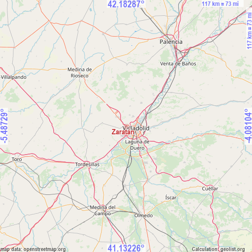
| Map corner | latitude | longitude |
|---|---|---|
| Upper-left | 42.18287°, | -5.48729° |
| Center: | 41.65971°, | -4.78417° |
| Lower-right: | 41.13226°, | -4.08104° |
| Map W x H: | 116.8×116.8 km | = 72.6×72.6mi |
| max Lat: | 43.74134° ⇑35% North |
| Zaratán: | 41.65971° |
| min Lat: | ⇓65% South 27.64134° |
| min Long | Zaratán | max Long |
| -18.00367° | -4.78417° | 4.2899° |
| W 30.5%⇐ | ⇒69.5% E |
Elevation
Elevation of Zaratán is 755 m = 2477 ft, and this is 157 m = 515 ft above average elevation for this country.
| Max E: |
1682 m = 5518 ft | 38.4% |
| Zaratán | 755 m 2477 ft | |
| Avg. | 598 m = 1962 ft | |
Min E: |
0 m = 0 ft | 61.6% |
See also: Spain elevation on elevation.city.
Geographical zone
Zaratán is located in North temperate zone (between Tropic of Cancer and the Arctic Circle). Distance of this Northern Tropic circle is 2026.2 km =1259 mi to South.| Distance of | km | miles | from Zaratán |
|---|---|---|---|
| North Pole | 5374.9 | 3339.8 | to North |
| Arctic Circle | 2769 | 1720.6 | to North |
| Tropic Cancer | 2026.2 | 1259 | to South |
| Equator | 4632.1 | 2878.3 | to South |


Nearby cities:
15 places around Zaratán: (largest is in red/bold)
• Arroyo de la Encomienda
5.7 km =3.5 mi,  190°
190°
• Cigales
13 km =8.1 mi,  33°
33°
• Ciguñuela
6.4 km =4 mi,  250°
250°
• Cistérniga
9.6 km =6 mi,  122°
122°
• Fuensaldaña
5.4 km =3.4 mi,  16°
16°
• Geria
11.8 km =7.3 mi,  220°
220°
• Laguna de Duero
10.1 km =6.3 mi,  149°
149°
• Mucientes
9.4 km =5.8 mi,  11°
11°
• Robladillo
11.9 km =7.4 mi,  241°
241°
• Santovenia de Pisuerga
8.7 km =5.4 mi,  63°
63°
• Simancas
8.5 km =5.3 mi,  205°
205°
• Valladolid
5 km =3.1 mi,  95°
95°
• Villanubla
6.5 km =4 mi,  312°
312°
• Villán de Tordesillas
13.7 km =8.5 mi, 237°
• Wamba
11.2 km =7 mi,  278°
278°
Sources, notices
• [Note1] Compared only with cities in Spain existing in our database
• [Src1] Map data: © OpenStreetMap contributors (CC-BY-SA)
• [Src2] Other city data from geonames.org with taken over terms of usage.
• [Src3] Geographical zone / Annual Mean Temperature by Robert A. Rohde @ Wikipedia
