Ariño geodata
Ariño (Aragon) is a seat of a third-order administrative division; located in Spain in Europe/Madrid (GMT+2) time zone. With population of 902 people, there are 3066 cities with bigger population in this country. Compared to other cities in Spain, 50.9% of cities are located further ↑North; 80.6% of cities are located further ←West and 60.4% of cities have higher elevation than Ariño. Note1


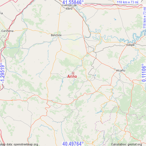
Ariño GPS coordinates[2]
41° 1' 48.684" North, 0° 35' 31.416" West
| Map corner | latitude | longitude |
|---|---|---|
| Upper-left | 41.55846°, | -1.29519° |
| Center: | 41.03019°, | -0.59206° |
| Lower-right: | 40.49764°, | 0.11106° |
| Map W x H: | 118×118 km | = 73.3×73.3mi |
| max Lat: | 43.74134° ⇑50.9% North |
| Ariño: | 41.03019° |
| min Lat: | ⇓49.1% South 27.64134° |
| min Long | Ariño | max Long |
| -18.00367° | -0.59206° | 4.2899° |
| W 80.6%⇐ | ⇒19.4% E |
Elevation
Elevation of Ariño is 521 m = 1709 ft, and this is 77 m = 253 ft below average elevation for this country.
| Max E: |
1682 m = 5518 ft | 60.4% |
| Avg. | 598 m = 1962 ft | |
| Ariño | 521 m = 1709 ft | |
Min E: |
0 m = 0 ft | 39.6% |
See also: Spain elevation on elevation.city.
Geographical zone
Ariño is located in North temperate zone (between Tropic of Cancer and the Arctic Circle). Distance of this Northern Tropic circle is 1956.2 km =1215.5 mi to South.| Distance of | km | miles | from Ariño |
|---|---|---|---|
| North Pole | 5444.9 | 3383.3 | to North |
| Arctic Circle | 2839 | 1764.1 | to North |
| Tropic Cancer | 1956.2 | 1215.5 | to South |
| Equator | 4562.1 | 2834.8 | to South |


Nearby cities:
15 places around Ariño: (largest is in red/bold)
• Alacón
8.9 km =5.5 mi,  266°
266°
• Albalate del Arzobispo
12.2 km =7.6 mi,  33°
33°
• Alcaine
12.8 km =8 mi,  228°
228°
• Alloza
8.6 km =5.3 mi,  142°
142°
• Andorra
13.5 km =8.4 mi,  116°
116°
• Cortes de Aragón
21.4 km =13.3 mi,  252°
252°
• Crivillén
16.4 km =10.2 mi,  175°
175°
• Estercuel
19.8 km =12.3 mi,  189°
189°
• Gargallo
21.6 km =13.4 mi, 178°
• Híjar
19.9 km =12.4 mi,  36°
36°
• Josa
16.9 km =10.5 mi,  240°
240°
• Lécera
21.8 km =13.5 mi,  332°
332°
• Muniesa
18.4 km =11.4 mi, 271°
• Obón
17.8 km =11.1 mi,  218°
218°
• Oliete
7.8 km =4.8 mi, 242°
Sources, notices
• [Note1] Compared only with cities in Spain existing in our database
• [Src1] Map data: © OpenStreetMap contributors (CC-BY-SA)
• [Src2] Other city data from geonames.org with taken over terms of usage.
• [Src3] Geographical zone / Annual Mean Temperature by Robert A. Rohde @ Wikipedia
