Alameda del Valle geodata
Alameda del Valle (Madrid) is a seat of a third-order administrative division; located in Spain in Europe/Madrid (GMT+2) time zone. With population of 217 people, there are 4938 cities with bigger population in this country. Compared to other cities in Spain, 53.5% of cities are located further ↑North; 57.5% of cities are located further →East and 93.7% of cities have lower elevation than Alameda del Valle. Note1


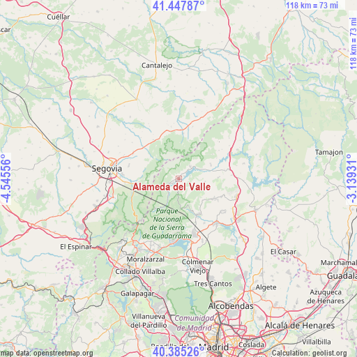
Alameda del Valle GPS coordinates[2]
40° 55' 7.32" North, 3° 50' 32.748" West
| Map corner | latitude | longitude |
|---|---|---|
| Upper-left | 41.44787°, | -4.54556° |
| Center: | 40.9187°, | -3.84243° |
| Lower-right: | 40.38526°, | -3.13931° |
| Map W x H: | 118.2×118.2 km | = 73.4×73.4mi |
| max Lat: | 43.74134° ⇑53.5% North |
| Alameda del Valle: | 40.9187° |
| min Lat: | ⇓46.5% South 27.64134° |
| min Long | Alameda del Val | max Long |
| -18.00367° | -3.84243° | 4.2899° |
| W 42.5%⇐ | ⇒57.5% E |
Elevation
Elevation of Alameda del Valle is 1111 m = 3645 ft, and this is 513 m = 1683 ft above average elevation for this country.
| Max E: |
1682 m = 5518 ft | 6.3% |
| Alameda del Valle | 1111 m 3645 ft | |
| Avg. | 598 m = 1962 ft | |
Min E: |
0 m = 0 ft | 93.7% |
See also: Spain elevation on elevation.city.
Geographical zone
Alameda del Valle is located in North temperate zone (between Tropic of Cancer and the Arctic Circle). Distance of this Northern Tropic circle is 1943.8 km =1207.8 mi to South.| Distance of | km | miles | from Alameda del Valle |
|---|---|---|---|
| North Pole | 5457.3 | 3391 | to North |
| Arctic Circle | 2851.4 | 1771.8 | to North |
| Tropic Cancer | 1943.8 | 1207.8 | to South |
| Equator | 4549.7 | 2827.1 | to South |


Nearby cities:
15 places around Alameda del Valle: (largest is in red/bold)
• Bustarviejo
13.2 km =8.2 mi,  121°
121°
• Canencia
9.1 km =5.7 mi,  98°
98°
• Collado Hermoso
14.8 km =9.2 mi,  334°
334°
• Garganta de los Montes
13.3 km =8.3 mi,  89°
89°
• Lozoya
5.5 km =3.4 mi,  51°
51°
• Miraflores de la Sierra
13.3 km =8.3 mi,  149°
149°
• Navafría
15.2 km =9.4 mi,  5°
5°
• Pelayos del Arroyo
16.9 km =10.5 mi, 330°
• Pinilla del Valle
2.2 km =1.4 mi,  73°
73°
• Rascafría
3.5 km =2.2 mi,  242°
242°
• San Ildefonso
13.9 km =8.6 mi,  262°
262°
• Sotosalbos
15.4 km =9.6 mi, 327°
• Torrecaballeros
17.3 km =10.7 mi,  298°
298°
• Trescasas
17 km =10.6 mi,  287°
287°
• Valdemanco
16.3 km =10.1 mi,  109°
109°
Sources, notices
• [Note1] Compared only with cities in Spain existing in our database
• [Src1] Map data: © OpenStreetMap contributors (CC-BY-SA)
• [Src2] Other city data from geonames.org with taken over terms of usage.
• [Src3] Geographical zone / Annual Mean Temperature by Robert A. Rohde @ Wikipedia
