Abizanda geodata
Abizanda (Aragon) is a seat of a third-order administrative division; located in Spain in Europe/Madrid (GMT+2) time zone. With population of 130 people, there are 5579 cities with bigger population in this country. Compared to other cities in Spain, 80.4% of cities are located further ↓South; 88% of cities are located further ←West and 52.7% of cities have higher elevation than Abizanda. Note1


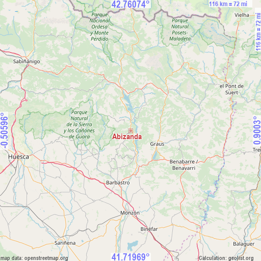
Abizanda GPS coordinates[2]
42° 14' 32.496" North, 0° 11' 49.812" East
| Map corner | latitude | longitude |
|---|---|---|
| Upper-left | 42.76074°, | -0.50596° |
| Center: | 42.24236°, | 0.19717° |
| Lower-right: | 41.71969°, | 0.9003° |
| Map W x H: | 115.8×115.8 km | = 72×72mi |
| max Lat: | 43.74134° ⇑19.6% North |
| Abizanda: | 42.24236° |
| min Lat: | ⇓80.4% South 27.64134° |
| min Long | Abizanda | max Long |
| -18.00367° | 0.19717° | 4.2899° |
| W 88%⇐ | ⇒12% E |
Elevation
Elevation of Abizanda is 627 m = 2057 ft, and this is 29 m = 95 ft above average elevation for this country.
| Max E: |
1682 m = 5518 ft | 52.7% |
| Abizanda | 627 m 2057 ft | |
| Avg. | 598 m = 1962 ft | |
Min E: |
0 m = 0 ft | 47.3% |
See also: Spain elevation on elevation.city.
Geographical zone
Abizanda is located in North temperate zone (between Tropic of Cancer and the Arctic Circle). Distance of this Northern Tropic circle is 2091 km =1299.3 mi to South.| Distance of | km | miles | from Abizanda |
|---|---|---|---|
| North Pole | 5310.2 | 3299.6 | to North |
| Arctic Circle | 2704.3 | 1680.4 | to North |
| Tropic Cancer | 2091 | 1299.3 | to South |
| Equator | 4696.9 | 2918.5 | to South |


Nearby cities:
15 places around Abizanda: (largest is in red/bold)
• Adahuesca
20 km =12.4 mi,  237°
237°
• Alquézar
16.1 km =10 mi, 241°
• Aínsa
19.8 km =12.3 mi,  346°
346°
• Bárcabo
10.5 km =6.5 mi,  269°
269°
• Capella
17.2 km =10.7 mi,  107°
107°
• Colungo
13.2 km =8.2 mi,  233°
233°
• El Grado
10.4 km =6.5 mi,  168°
168°
• Estada
19.2 km =11.9 mi, 171°
• Estadilla
21 km =13 mi, 169°
• Graus
13 km =8.1 mi,  117°
117°
• Naval
6.5 km =4 mi,  215°
215°
• Palo
9.7 km =6 mi,  23°
23°
• Salas Altas
17.8 km =11.1 mi, 216°
• Salas Bajas
18.3 km =11.4 mi,  210°
210°
• Secastilla
8.9 km =5.5 mi,  139°
139°
Sources, notices
• [Note1] Compared only with cities in Spain existing in our database
• [Src1] Map data: © OpenStreetMap contributors (CC-BY-SA)
• [Src2] Other city data from geonames.org with taken over terms of usage.
• [Src3] Geographical zone / Annual Mean Temperature by Robert A. Rohde @ Wikipedia
