Graus geodata
Graus (Aragon) is a seat of a third-order administrative division; located in Spain in Europe/Madrid (GMT+2) time zone. With population of 3,436 people, there are 1602 cities with bigger population in this country. Compared to other cities in Spain, 79% of cities are located further ↓South; 88.4% of cities are located further ←West and 64.7% of cities have higher elevation than Graus. Note1


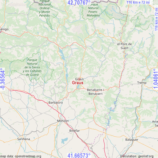
Graus GPS coordinates[2]
42° 11' 19.86" North, 0° 20' 14.964" East
| Map corner | latitude | longitude |
|---|---|---|
| Upper-left | 42.70767°, | -0.36564° |
| Center: | 42.18885°, | 0.33749° |
| Lower-right: | 41.66573°, | 1.04061° |
| Map W x H: | 115.9×115.9 km | = 72×72mi |
| max Lat: | 43.74134° ⇑21% North |
| Graus: | 42.18885° |
| min Lat: | ⇓79% South 27.64134° |
| min Long | Graus | max Long |
| -18.00367° | 0.33749° | 4.2899° |
| W 88.4%⇐ | ⇒11.6% E |
Elevation
Elevation of Graus is 464 m = 1522 ft, and this is 134 m = 440 ft below average elevation for this country.
| Max E: |
1682 m = 5518 ft | 64.7% |
| Avg. | 598 m = 1962 ft | |
| Graus | 464 m = 1522 ft | |
Min E: |
0 m = 0 ft | 35.3% |
See also: Spain elevation on elevation.city.
Geographical zone
Graus is located in North temperate zone (between Tropic of Cancer and the Arctic Circle). Distance of this Northern Tropic circle is 2085 km =1295.6 mi to South.| Distance of | km | miles | from Graus |
|---|---|---|---|
| North Pole | 5316.1 | 3303.3 | to North |
| Arctic Circle | 2710.2 | 1684 | to North |
| Tropic Cancer | 2085 | 1295.6 | to South |
| Equator | 4691 | 2914.9 | to South |


Nearby cities:
15 places around Graus: (largest is in red/bold)
• Abizanda
13 km =8.1 mi,  297°
297°
• Benavarri / Benabarre
15.1 km =9.4 mi,  127°
127°
• Bárcabo
22.9 km =14.2 mi,  285°
285°
• Capella
4.9 km =3 mi,  80°
80°
• Castigaleu
20 km =12.4 mi,  85°
85°
• Colungo
22.3 km =13.9 mi,  264°
264°
• El Grado
10.3 km =6.4 mi,  245°
245°
• Estada
15.6 km =9.7 mi,  213°
213°
• Estadilla
16.6 km =10.3 mi, 207°
• Fonz
20.9 km =13 mi,  198°
198°
• Lascuarre
15.1 km =9.4 mi, 86°
• Naval
15.3 km =9.5 mi,  272°
272°
• Palo
16.8 km =10.4 mi,  332°
332°
• Salas Bajas
23.1 km =14.4 mi,  244°
244°
• Secastilla
5.8 km =3.6 mi, 261°
Sources, notices
• [Note1] Compared only with cities in Spain existing in our database
• [Src1] Map data: © OpenStreetMap contributors (CC-BY-SA)
• [Src2] Other city data from geonames.org with taken over terms of usage.
• [Src3] Geographical zone / Annual Mean Temperature by Robert A. Rohde @ Wikipedia
