Nastola geodata
Nastola (Päijänne Tavastia) is a populated place; located in Finland in Europe/Helsinki (GMT+3) time zone. With population of 14,911 people, there are 75 cities with bigger population in this country. Compared to other cities in Finland, 70.5% of cities are located further ↑North; 69.4% of cities are located further ←West and 75.2% of cities have lower elevation than Nastola. Note1


Nastola GPS coordinates[2]
60° 57' 0" North, 25° 55' 59.988" East
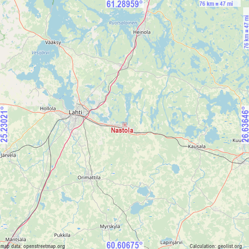
| Map corner | latitude | longitude |
|---|---|---|
| Upper-left | 61.28959°, | 25.23021° |
| Center: | 60.95°, | 25.93333° |
| Lower-right: | 60.60675°, | 26.63646° |
| Map W x H: | 75.9×75.9 km | = 47.2×47.2mi |
| max Lat: | 69.90864° ⇑70.5% North |
| Nastola: | 60.95° |
| min Lat: | ⇓29.5% South 59.83333° |
| min Long | Nastola | max Long |
| 21.2° | 25.93333° | 30.93276° |
| W 69.4%⇐ | ⇒30.6% E |
Elevation
Elevation of Nastola is 112 m = 367 ft, and this is 34.9 m = 115 ft above average elevation for this country.
| Max E: |
299 m = 981 ft | 24.8% |
| Nastola | 112 m 367 ft | |
| Avg. | 77.1 m = 253 ft | |
Min E: |
1 m = 3 ft | 75.2% |
See also: Finland elevation on elevation.city.
Geographical zone
Nastola is located in North temperate zone (between Tropic of Cancer and the Arctic Circle). Distance of this North polar circle is 624.2 km =387.9 mi to North.| Distance of | km | miles | from Nastola |
|---|---|---|---|
| North Pole | 3230.1 | 2007.1 | to North |
| Arctic Circle | 624.2 | 387.9 | to North |
| Tropic Cancer | 4171.1 | 2591.8 | to South |
| Equator | 6777 | 4211 | to South |


Nearby cities:
15 places around Nastola: (largest is in red/bold)
• Artjärvi
23.9 km =14.9 mi,  161°
161°
• Asikkala
37.7 km =23.4 mi,  321°
321°
• Elimäki
38.8 km =24.1 mi,  131°
131°
• Heinola
29 km =18 mi,  11°
11°
• Hollola
24 km =14.9 mi,  283°
283°
• Hollola
29.2 km =18.1 mi,  292°
292°
• Iitti
22.7 km =14.1 mi,  105°
105°
• Jaala
31.7 km =19.7 mi,  68°
68°
• Järvelä
36.3 km =22.6 mi,  255°
255°
• Kärkölä
37.1 km =23.1 mi, 264°
• Lahti
15.1 km =9.4 mi, 283°
• Lapinjärvi
38.9 km =24.2 mi, 158°
• Myrskylä
31.5 km =19.6 mi,  188°
188°
• Orimattila
19.5 km =12.1 mi,  214°
214°
• Pukkila
38.8 km =24.1 mi, 210°
Sources, notices
• [Note1] Compared only with cities in Finland existing in our database
• [Src1] Map data: © OpenStreetMap contributors (CC-BY-SA)
• [Src2] Other city data from geonames.org with taken over terms of usage.
• [Src3] Geographical zone / Annual Mean Temperature by Robert A. Rohde @ Wikipedia
