Lehtimäki geodata
Lehtimäki (Southern Ostrobothnia) is a seat of a third-order administrative division; located in Finland in Europe/Helsinki (GMT+3) time zone. With population of 1,924 people, there are 362 cities with bigger population in this country. Compared to other cities in Finland, 66.5% of cities are located further ↓South; 61.8% of cities are located further →East and 98.7% of cities have lower elevation than Lehtimäki. Note1


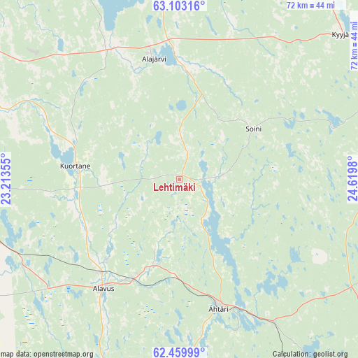
Lehtimäki GPS coordinates[2]
62° 46' 59.988" North, 23° 55' 0.012" East
| Map corner | latitude | longitude |
|---|---|---|
| Upper-left | 63.10316°, | 23.21355° |
| Center: | 62.78333°, | 23.91667° |
| Lower-right: | 62.45999°, | 24.6198° |
| Map W x H: | 71.5×71.5 km | = 44.4×44.4mi |
| max Lat: | 69.90864° ⇑33.5% North |
| Lehtimäki: | 62.78333° |
| min Lat: | ⇓66.5% South 59.83333° |
| min Long | Lehtimäki | max Long |
| 21.2° | 23.91667° | 30.93276° |
| W 38.2%⇐ | ⇒61.8% E |
Elevation
Elevation of Lehtimäki is 206 m = 676 ft, and this is 128.9 m = 423 ft above average elevation for this country.
| Max E: |
299 m = 981 ft | 1.3% |
| Lehtimäki | 206 m 676 ft | |
| Avg. | 77.1 m = 253 ft | |
Min E: |
1 m = 3 ft | 98.7% |
See also: Finland elevation on elevation.city.
Geographical zone
Lehtimäki is located in North temperate zone (between Tropic of Cancer and the Arctic Circle). Distance of this North polar circle is 420.3 km =261.2 mi to North.| Distance of | km | miles | from Lehtimäki |
|---|---|---|---|
| North Pole | 3026.2 | 1880.4 | to North |
| Arctic Circle | 420.3 | 261.2 | to North |
| Tropic Cancer | 4374.9 | 2718.4 | to South |
| Equator | 6980.9 | 4337.7 | to South |


Nearby cities:
15 places around Lehtimäki: (largest is in red/bold)
• Alajärvi
24.6 km =15.3 mi,  348°
348°
• Alavus
27 km =16.8 mi,  214°
214°
• Karstula
45 km =28 mi,  78°
78°
• Kuortane
21.3 km =13.2 mi,  275°
275°
• Kyyjärvi
43.1 km =26.8 mi,  49°
49°
• Lappajärvi
48.5 km =30.1 mi,  342°
342°
• Lapua
50.5 km =31.4 mi,  294°
294°
• Nurmo
51.4 km =31.9 mi, 275°
• Perho
54.4 km =33.8 mi,  27°
27°
• Pylkönmäki
46.8 km =29.1 mi,  106°
106°
• Soini
17.8 km =11.1 mi,  58°
58°
• Töysä
18 km =11.2 mi,  196°
196°
• Vimpeli
42.4 km =26.3 mi, 353°
• Ähtäri
26.6 km =16.5 mi,  163°
163°
• Älajärvi
24.7 km =15.3 mi, 348°
Sources, notices
• [Note1] Compared only with cities in Finland existing in our database
• [Src1] Map data: © OpenStreetMap contributors (CC-BY-SA)
• [Src2] Other city data from geonames.org with taken over terms of usage.
• [Src3] Geographical zone / Annual Mean Temperature by Robert A. Rohde @ Wikipedia
