Ngatik geodata
Ngatik (Pohnpei) is a seat of a second-order administrative division; located in Micronesia in Pacific/Pohnpei (GMT+11) time zone. With population of 640 people, there are 12 cities with bigger population in this country. Compared to other cities in Micronesia, 68.3% of cities are located further ↑North; 81.7% of cities are located further ←West and 73.3% of cities have lower elevation than Ngatik. Note1


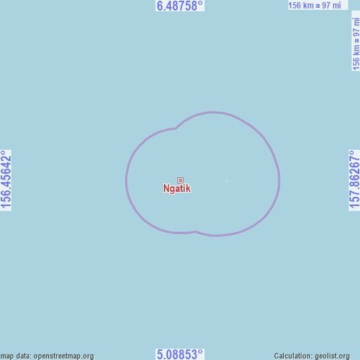
Ngatik GPS coordinates[2]
5° 47' 18.564" North, 157° 9' 34.344" East
| Map corner | latitude | longitude |
|---|---|---|
| Upper-left | 6.48758°, | 156.45642° |
| Center: | 5.78849°, | 157.15954° |
| Lower-right: | 5.08853°, | 157.86267° |
| Map W x H: | 155.6×155.6 km | = 96.7×96.7mi |
| max Lat: | 9.766° ⇑68.3% North |
| Ngatik: | 5.78849° |
| min Lat: | ⇓31.7% South 1.07861° |
| min Long | Ngatik | max Long |
| 137.484° | 157.15954° | 163.02609° |
| W 81.7%⇐ | ⇒18.3% E |
Elevation
Elevation of Ngatik is 16 m = 52 ft, and this is 1.2 m = 4 ft above average elevation for this country.
| Max E: |
92 m = 302 ft | 26.7% |
| Ngatik | 16 m 52 ft | |
| Avg. | 14.8 m = 49 ft | |
Min E: |
1 m = 3 ft | 73.3% |
See also: Micronesia elevation on elevation.city.
Geographical zone
Ngatik is located in North Torrid zone (between Equator and Tropic of Cancer). Distance of Equator is 643.6 km =399.9 mi to South.| Distance of | km | miles | from Ngatik |
|---|---|---|---|
| North Pole | 9363.4 | 5818.1 | to North |
| Arctic Circle | 6757.6 | 4199 | to North |
| Tropic Cancer | 1962.3 | 1219.3 | to North |
| Equator | 643.6 | 399.9 | to South |


Nearby cities:
15 places around Ngatik: (largest is in red/bold)
• Ettal
398.4 km =247.6 mi,  266°
266°
• Kolonia
174.5 km =108.4 mi,  41°
41°
• Kolonia Town
174.5 km =108.4 mi, 41°
• Lukunor
370.8 km =230.4 mi, 265°
• Lukunor Village
370.7 km =230.3 mi, 265°
• Madolenihm Municipality Government
171.4 km =106.5 mi,  47°
47°
• Mokil
304.8 km =189.4 mi,  70°
70°
• Nukuoro
325.4 km =202.2 mi,  228°
228°
• Oneop
382.9 km =237.9 mi, 265°
• Oneop Village
382.9 km =237.9 mi, 265°
• Palikir - National Government Center
168 km =104.4 mi, 41°
• Pingelap
394.6 km =245.2 mi,  83°
83°
• Satowan
382 km =237.4 mi,  262°
262°
• Satowan Village
381.9 km =237.3 mi, 262°
• Ta
392.6 km =244 mi, 261°
Sources, notices
• [Note1] Compared only with cities in Micronesia existing in our database
• [Src1] Map data: © OpenStreetMap contributors (CC-BY-SA)
• [Src2] Other city data from geonames.org with taken over terms of usage.
• [Src3] Geographical zone / Annual Mean Temperature by Robert A. Rohde @ Wikipedia
