Lukunor Village geodata
Lukunor Village (Chuuk) is a populated place; located in Micronesia in Pacific/Chuuk (GMT+10) time zone. With population of 927 people, there are 7 cities with bigger population in this country. Compared to other cities in Micronesia, 73.3% of cities are located further ↑North; 76.7% of cities are located further ←West and 68.3% of cities have higher elevation than Lukunor Village. Note1


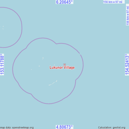
Lukunor Village GPS coordinates[2]
5° 30' 25.2" North, 153° 49' 15.6" East
| Map corner | latitude | longitude |
|---|---|---|
| Upper-left | 6.20645°, | 153.11788° |
| Center: | 5.507°, | 153.821° |
| Lower-right: | 4.80673°, | 154.52413° |
| Map W x H: | 155.6×155.6 km | = 96.7×96.7mi |
| max Lat: | 9.766° ⇑73.3% North |
| Lukunor Village: | 5.507° |
| min Lat: | ⇓26.7% South 1.07861° |
| min Long | Lukunor Village | max Long |
| 137.484° | 153.821° | 163.02609° |
| W 76.7%⇐ | ⇒23.3% E |
Elevation
Elevation of Lukunor Village is 9 m = 30 ft, and this is 5.8 m = 19 ft below average elevation for this country.
| Max E: |
92 m = 302 ft | 68.3% |
| Avg. | 14.8 m = 49 ft | |
| Lukunor Village | 9 m = 30 ft | |
Min E: |
1 m = 3 ft | 31.7% |
See also: Micronesia elevation on elevation.city.
Geographical zone
Lukunor Village is located in North Torrid zone (between Equator and Tropic of Cancer). Distance of Equator is 612.3 km =380.5 mi to South.| Distance of | km | miles | from Lukunor Village |
|---|---|---|---|
| North Pole | 9394.7 | 5837.6 | to North |
| Arctic Circle | 6788.9 | 4218.4 | to North |
| Tropic Cancer | 1993.6 | 1238.8 | to North |
| Equator | 612.3 | 380.5 | to South |


Nearby cities:
15 places around Lukunor Village: (largest is in red/bold)
• Ettal
30 km =18.6 mi,  288°
288°
• Kuttu
40.7 km =25.3 mi,  261°
261°
• Kuttu Village
40.4 km =25.1 mi, 262°
• Losap
195.1 km =121.2 mi,  322°
322°
• Lukunor
0.1 km =0.1 mi,  270°
270°
• Moch
31.1 km =19.3 mi, 266°
• Moch Village
31.1 km =19.3 mi, 266°
• Namoluk
87.9 km =54.6 mi,  301°
301°
• Nema
214.9 km =133.5 mi, 320°
• Oneop
12.2 km =7.6 mi, 269°
• Oneop Village
12.2 km =7.6 mi, 269°
• Piis
192.6 km =119.7 mi, 319°
• Satowan
21.3 km =13.2 mi,  205°
205°
• Satowan Village
21.3 km =13.2 mi, 205°
• Ta
31.3 km =19.4 mi,  217°
217°
Sources, notices
• [Note1] Compared only with cities in Micronesia existing in our database
• [Src1] Map data: © OpenStreetMap contributors (CC-BY-SA)
• [Src2] Other city data from geonames.org with taken over terms of usage.
• [Src3] Geographical zone / Annual Mean Temperature by Robert A. Rohde @ Wikipedia
