Ettal geodata
Ettal (Chuuk) is a seat of a second-order administrative division; located in Micronesia in Pacific/Chuuk (GMT+10) time zone. In our database, there are 19 cities with bigger population. Compared to other cities in Micronesia, 70% of cities are located further ↑North; 65% of cities are located further ←West and 100% of cities have higher elevation than Ettal. Note1


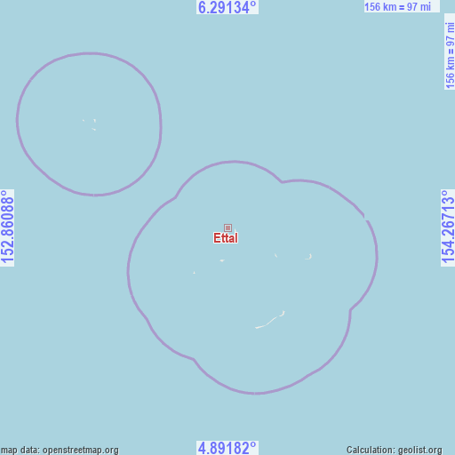
Ettal GPS coordinates[2]
5° 35' 31.2" North, 153° 33' 50.4" East
| Map corner | latitude | longitude |
|---|---|---|
| Upper-left | 6.29134°, | 152.86088° |
| Center: | 5.592°, | 153.564° |
| Lower-right: | 4.89182°, | 154.26713° |
| Map W x H: | 155.6×155.6 km | = 96.7×96.7mi |
| max Lat: | 9.766° ⇑70% North |
| Ettal: | 5.592° |
| min Lat: | ⇓30% South 1.07861° |
| min Long | Ettal | max Long |
| 137.484° | 153.564° | 163.02609° |
| W 65%⇐ | ⇒35% E |
Elevation
Elevation of Ettal is 1 m = 3 ft, and this is 13.8 m = 45 ft below average elevation for this country.
| Max E: |
92 m = 302 ft | 100% |
| Avg. | 14.8 m = 49 ft | |
| Ettal | 1 m = 3 ft | |
Min E: |
1 m = 3 ft | 0% |
See also: Micronesia elevation on elevation.city.
Geographical zone
Ettal is located in North Torrid zone (between Equator and Tropic of Cancer). Distance of Equator is 621.8 km =386.4 mi to South.| Distance of | km | miles | from Ettal |
|---|---|---|---|
| North Pole | 9385.3 | 5831.8 | to North |
| Arctic Circle | 6779.4 | 4212.5 | to North |
| Tropic Cancer | 1984.1 | 1232.9 | to North |
| Equator | 621.8 | 386.4 | to South |


Nearby cities:
15 places around Ettal: (largest is in red/bold)
• Kuttu
19.4 km =12.1 mi,  217°
217°
• Kuttu Village
19 km =11.8 mi, 217°
• Losap
171 km =106.3 mi,  327°
327°
• Lukunor
29.9 km =18.6 mi,  108°
108°
• Lukunor Village
30 km =18.6 mi, 108°
• Moch
11.5 km =7.1 mi,  193°
193°
• Moch Village
11.4 km =7.1 mi, 193°
• Namoluk
59.1 km =36.7 mi,  307°
307°
• Nema
190 km =118.1 mi,  324°
324°
• Oneop
18.8 km =11.7 mi,  120°
120°
• Oneop Village
18.8 km =11.7 mi, 120°
• Piis
167.8 km =104.3 mi, 325°
• Satowan
34.6 km =21.5 mi,  146°
146°
• Satowan Village
34.6 km =21.5 mi, 146°
• Ta
35.5 km =22.1 mi,  164°
164°
Sources, notices
• [Note1] Compared only with cities in Micronesia existing in our database
• [Src1] Map data: © OpenStreetMap contributors (CC-BY-SA)
• [Src2] Other city data from geonames.org with taken over terms of usage.
• [Src3] Geographical zone / Annual Mean Temperature by Robert A. Rohde @ Wikipedia
