Moch Village geodata
Moch Village (Chuuk) is a populated place; located in Micronesia in Pacific/Chuuk (GMT+10) time zone. With population of 854 people, there are 10 cities with bigger population in this country. Compared to other cities in Micronesia, 80% of cities are located further ↑North; 63.3% of cities are located further ←West and 73.3% of cities have lower elevation than Moch Village. Note1


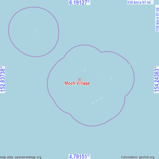
Moch Village GPS coordinates[2]
5° 29' 30.48" North, 153° 32' 25.8" East
| Map corner | latitude | longitude |
|---|---|---|
| Upper-left | 6.19127°, | 152.83738° |
| Center: | 5.4918°, | 153.5405° |
| Lower-right: | 4.79151°, | 154.24363° |
| Map W x H: | 155.6×155.6 km | = 96.7×96.7mi |
| max Lat: | 9.766° ⇑80% North |
| Moch Village: | 5.4918° |
| min Lat: | ⇓20% South 1.07861° |
| min Long | Moch Village | max Long |
| 137.484° | 153.5405° | 163.02609° |
| W 63.3%⇐ | ⇒36.7% E |
Elevation
Elevation of Moch Village is 16 m = 52 ft, and this is 1.2 m = 4 ft above average elevation for this country.
| Max E: |
92 m = 302 ft | 26.7% |
| Moch Village | 16 m 52 ft | |
| Avg. | 14.8 m = 49 ft | |
Min E: |
1 m = 3 ft | 73.3% |
See also: Micronesia elevation on elevation.city.
Geographical zone
Moch Village is located in North Torrid zone (between Equator and Tropic of Cancer). Distance of Equator is 610.6 km =379.4 mi to South.| Distance of | km | miles | from Moch Village |
|---|---|---|---|
| North Pole | 9396.4 | 5838.7 | to North |
| Arctic Circle | 6790.5 | 4219.4 | to North |
| Tropic Cancer | 1995.3 | 1239.8 | to North |
| Equator | 610.6 | 379.4 | to South |


Nearby cities:
15 places around Moch Village: (largest is in red/bold)
• Ettal
11.4 km =7.1 mi,  13°
13°
• Kuttu
10.1 km =6.3 mi,  244°
244°
• Kuttu Village
9.8 km =6.1 mi,  246°
246°
• Losap
179.3 km =111.4 mi,  330°
330°
• Lukunor
31 km =19.3 mi,  86°
86°
• Lukunor Village
31.1 km =19.3 mi, 86°
• Moch
0.1 km =0.1 mi,  270°
270°
• Namoluk
64.6 km =40.1 mi,  316°
316°
• Nema
197.8 km =122.9 mi, 327°
• Oneop
18.9 km =11.7 mi, 85°
• Oneop Village
18.9 km =11.7 mi, 85°
• Piis
175.7 km =109.2 mi, 328°
• Satowan
28 km =17.4 mi,  128°
128°
• Satowan Village
28.1 km =17.5 mi, 128°
• Ta
26 km =16.2 mi,  152°
152°
Sources, notices
• [Note1] Compared only with cities in Micronesia existing in our database
• [Src1] Map data: © OpenStreetMap contributors (CC-BY-SA)
• [Src2] Other city data from geonames.org with taken over terms of usage.
• [Src3] Geographical zone / Annual Mean Temperature by Robert A. Rohde @ Wikipedia
